Oct. 18, 2017. The June/July issue of AURORA, the journal of the ANARE Club, carries an article about the 2016 Cordell Expedition to Heard Island. The article, authored by Expedition Organizer/Leader Robert Schmieder, highlights the expedition's first survey of Stephenson Lagoon, the lake formed by the melting of the Stephenson Glacier. The article described this event:
...during one three-day period we made an exploratory trip to the southeast corner (Spit Bay). There, over the course of only a decade or so, a two-mile-long glacier had almost completely melted, filling its carved-out basin with water and getting a new name: Stephenson Lagoon. It’s two miles long, north-to-south.
We entered the lagoon through its surf-demolished southern breakwater, the first people ever to go inside. It took only a glance to resolve a major ambiguity from the satellite images: exposures of blue ice of the glaciers, revealed when the termini broke away. There are literally hundreds of these features. Near our first landing we found the first such feature we had identified in the satellite images: a huge chunk of glacier had slid down its ice scarp and piled up on the shore of a tarn. It had happened suddenly, sometime in the past 10 years.
Other expressions of glacial deterioration were numerous meltwater streams, including one that appeared out of nowhere and dumped prodigious amounts of fine sediment into Stephenson Lagoon. Many of these features were eerily familiar to us; we had studied the satellite images in detail, and much of what we saw there we now saw as the real thing.
At the end of the article, the author summarizes the major conclusions from the expedition:
From these and many other sources, it is clear that:
(1) The climate change experienced on Heard Island is driven by global climate change;
(2) The local climate changes are large;
(3) The effects of the change on the ecosystem are major; and
(4) The diversity is inadequately documented and poorly understood.
This set of connections provided strong incentive for the 2016 Cordell expedition, and will continue to provide strong incentive for more research expeditions in the future.
|
AUSTRALIA ISSUES HEAD ISLAND STAMPS
Oct. 4, 2017. On September 5, the Australian government has issued a set of postage stamps with images of Heard Island. The four stanps show images of the Baudissin Glacier, King penguins at Atlas Cove, Kerguelen cabbage with orange lichen, and Southern elephant seals. The stamps are all in the denomination of $1 (Australian).
Earlier, team member Alan Cheshire arranged to obtain a collection of first day issue envelopes, showing additional images of Heard Island, together with the four $1 stamps. One of the envelopes is a minisheet, the other is a four-pack. These products are available at face value from the Australian Postal Corporation https://australiapostcollectables.com.au/stamp-issues/heard-island.
Technical details:
| Issue date |
5 September 2017 |
| FDI withdrawal |
4 October 2017 |
| Denomination |
4 × $1 |
| Stamp and product design |
Melinda Coombes, Whitechurch Coombes Design |
| Printer |
EGO |
| Paper |
Tullis Russell |
| Printing process |
Offset lithography |
| Stamp size |
35mm × 35mm |
| Minisheet size |
170mm x 80mm |
| Perforations |
4.28 × 14.28 |
| Sheet layout |
Module of 50 |
| National postmark |
Kingston, Tas 7050 |
|
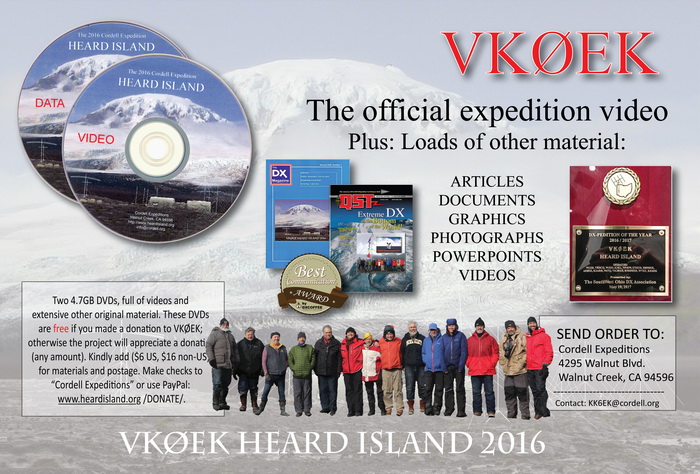
OFFICIAL EXPEDITION VIDEO AND EXTENSIVE DATA FILES
RELEASED ON TWO DVDs
|
| Ad for the VKØEK official video and data files, to be published in DX Magazine. Click this image to enlarge. |
Sept. 10, 2017. The official 2016 Heard Island Expedition VKØEK video and data files have been released.
The video is 45 minutes duration, and covers all aspect of the stay on Heard Island. It is a near-professionial-quality productioin, with narration, sound, score, and full credits.
The DVDs also include several other videos relating to Heard Island, including the videos from VKØIR 1997 and the VKØEK video by team member Vadym Ivliev UT6UD. Also included on the DATA DVD are thousands of pictures, official documents, the Final Report to the Australian Government, PowerPoint programs, graphics, and reprints of published articles.
The two 4.7 GB DVDs are free if you made a donation to the expedition, otherwise you are welcome to make any donation you wish with your order. Because of direct expenses, a postage/materials fee of $6 U.S., $16 otherwise is requested.You can order the DVDs by sending your request to
CORDELL EXPEDITIONS
4295 Walnut Blvd.
Walnut Creek, CA 94596
Inquires can be made to the Expedition Organizer/Leader Robert Schmieder KK6EK@cordell.org
|
EXPEDITION RECEIVES "BEST COMMUNICATION"
AWARD FROM DXCOFFEE

|
| The DXCoffee award for "Best Communication" by a DXpedition |
August 24, 2017. The 2016 Heard Island Expedition VKØEK has received the award for "Best Communication [by a DXpedition]" from DxCoffee. The award is also suppoted by DXUniversity. This is the second such award received by Cordell Expeditions, the first being for TX5K Clipperton 2013.
In the article posted on the website www.dxcoffee.com, the citation reads:
"In our annual acknowledgment to Dxpeditions providing the 'best communication', the 2016 award could not go to anyone else but VKØEK, the well-known Dxpedition to Heard island.
The amount of information made available to the international community is simply outstanding. Even several months before the operation, many extremely exhaustive newsletters were already circulating. These are still available here.
If you visit the DXpedition’s websites http://www.heardisland.org and https://vk0ek.org, you could spend hours reading many articles with reports, descriptions and various stories of every aspect concerning this excellent Dxpedition. We said 'reading'… oh well, not just that. Besides readings, there are many videos and photo galleries, giving an exact idea of what the operators experienced."
In response, the Cordell Expeditions team expressed sincere appreciation:
"On behalf of the VKØEK team, their families, the support groups in California, U. S. East Coast, Cape Town (South Africa), and Perth (Western Australia), about a hundred amateur radio and commercial organizations, and nearly 10,000 individual DXers, we express our sincere appreciation for this honor.
It was, in fact, one of our central goals to extend the outreach to various communities, principally using social media and satellite-based real-time communications, as well as the highest standards and fastest response time in the QSL operation, activities that go beyond simply logging QSOs during the operation. We believe that the future of DX must include a widened range of communications activities not traditionally associated with a classic (20th-Century) DXpedition.
The recognition by DX Coffee that extended communications are an important part of this future is welcomed by us, and based on the popularity of the various activities implemented for VKØEK, by the vast majority of DXers worldwide.
Thank you so much for highlighting this important part of DX and amateur radio in general. --Robert Schmieder, KK6EK, Organizer and Expedition Leader, VKØEK."
More information about this award is available at: http://www.dxcoffee.com/eng/communication-award. |
EXPEDITION RECEIVES TWO NEW AWARDS

|
| The award from CQ ham radio (Japan International DX Medeting 2016. The citation reads "You have overcome a lot of difficulties to execute the DXpedition successfully, and provided pleasure and a deep impression to DX audiences by using [the] DXA system that enable[s] DXers to know their QSOs in real time." |

|
|
The award from the German DX Foundation. "Best DXpeditions 2016 (third place). Presented at Ham Radio Friedrichshaven, Germany, 15 July 2017 by Franz Langner DJ9ZB. |
July 15, 2017. The 2016 Heard Island Expedition VKØEK has received two more awards: a citation for the use of DXA from Japan CQ ham radio, and a certificate for DXpedition of the Year 2016 (third place) from the German DX Foundation.
The awards were presented at Ham Radio 2017 Friedrichshafen, Germany, the international ham radio convention, by Franz Langner DJ9ZB, president of the GDXF. On hand to accept the awards (with pleasure!) were Expedition Organizer and Leader Robert Schmieder KK6EK, team members Dave Farnsworth WJ2O, Hans-Peter Blattler HB9BXE, and South Africa support coordinator Paul Johnson ZS1S. |
HEARD ISLAND LIMPET IDENTIFIED
 |
 |
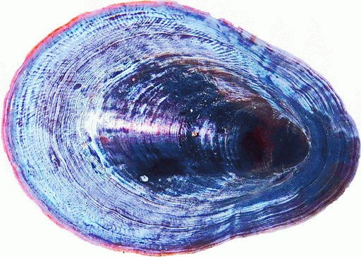
| The limpet collected at Heard Island (dorsal side). Photo: Robert Schmieder
|
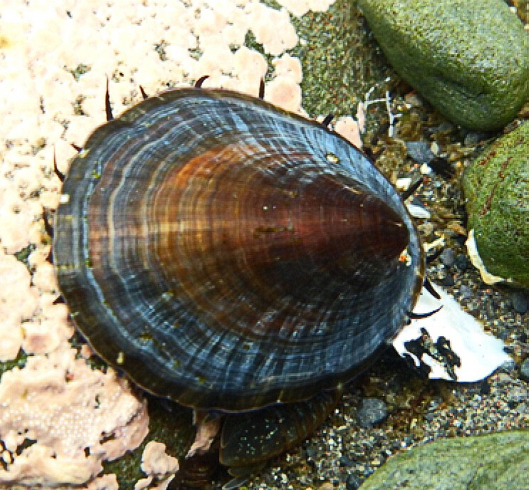
Nacella kerguelenensi. Photo: Dr. Elie Poulin in situ at Kerguelen Island [forwarded by Claudio Wevar]
|
 |
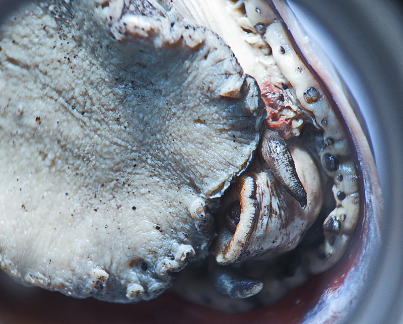 |
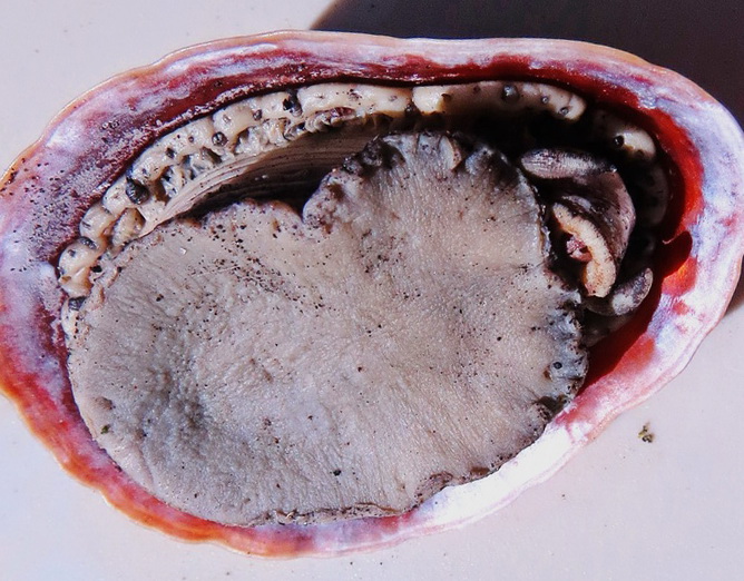
| The limpet collected at Heard Island (ventral side). Photo: Robert Schmieder
|
The limpet collected at Heard Island (ventral side, showing foot, head, tentacle, ). Photo: Robert Schmieder |
June 6, 2017. During the expedition we collected one specimen of a limpet. The specimen is 45x33x11 mm. It was fixed and preserved in ETOH. Initial examination indicated it was likely in the genus Nacella, described by Wikipedia as follows:
Among the candidate species we found were Nacella kerguelenensis, Nacella macquariensis, and Nacella concinna. To resolve this uncertainty, we contacted Dr. Claudio Gonzalez Wevar, a Chilean researcher at the Universidad de Magallanes, Chile. Wevar and his colleagues are working in the biogeography of the limpet genus Nacella across its distribution in the Southern Ocean. He confirmed the unambiguous identification of the Heard Island specimen as Nacella kerguelenensis (E. A. Smith, 1877). Dr. Wevar sent the following note:
This limpet is also known from New Zealand, where it is described as: "Length 80mm, Width 65mm, Macquarie Island record based on 4 beach worn shells found in 1914, which may have drifted there on floating kelp." [http://www.mollusca.co.nz/checklist_family.php?family=Nacellidae]. [Note that this source (and some other sources) spells the species as "kerguelensis" in contrast to "kerguelenensis".]
We thank Dr. Wevar for the identification of this specimen.
References:
Gonzalez-Wevar CA, Nakano T, Cañete J, and Poulin E (2010) Molecular phylogeny and historical biogeography of Nacella (Patellogastropoda: Nacellidae) in the Southern Ocean. Molecular Phylogenetics and Evolution, 56: 115–124. DOI: 10.1016/j.ympev.2010.02.001
Gonzalez-Wevar CA, Nakano T, Cañete J, Poulin E (2011) Concerted genetic, morphological and ecological diversification in Nacella limpets in the Magellanic Province. Molecular Ecology, 20: 1936–1951. DOI: 10.1111/j.1365-294X.2011.05065.x
González-Wevar CA, Saucède T, Morley SA, Chown SL, and Poulin E (2013) Extinction and recolonization of maritime Antarctica in the limpet Nacella concinna (Strebel, 1908) during the last glacial cycle: toward a model of Quaternary biogeography in shallow Antarctic invertebrates. Molecular Ecology, 22: 5221-5236. DOI: 10.1111/mec.12465
Poulin E, Gonzalez-Wevar CA, Díaz A, Gérard K, and Hüne M (2014) Divergence between Antarctic and South American marine invertebrates: What molecular biology tells us about Scotia Arc geodynamics and the intensification of the Antarctic Circumpolar Current. Global and Planetary Change, 123(B): 392–399. DOI: 10.1016/j.gloplacha.2014.07.017
Claudio A. Gonzalez-Wevar, et al. (2017) Following the Antarctic Circumpolar Currrent: patterns and processes in the biogeography of the limpet Nacella (Mollusca: Patellogastropoda) across the Southern Ocean Journal of Biogeography 4: 861.
Claudio A. Gonzalez-Wevar, Steven L. Chown, Simon Morley, Nestor Coria, Thomas Sauce´de, Elie Poulin (2014) Out of Antarctica: quaternary colonization of sub-Antarctic Marion Island by the limpet genus Nacella (Patellogastropoda: Nacellidae). Polar Biol. Springer-Verlag Berlin Heidelberg. DOI: 10.1007/s00300-014-1620-9. |
DXPEDITION OF THE YEAR!
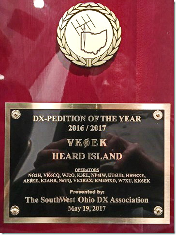 Photo Dave Lloyd K3EL Photo Dave Lloyd K3EL |
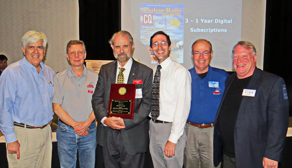 Adam K2ARB, Dave K3EL, Bob KK6EK, Bill AEØEE, Ken NG2H, and Rich KY6R. Photo Kay Schmieder Adam K2ARB, Dave K3EL, Bob KK6EK, Bill AEØEE, Ken NG2H, and Rich KY6R. Photo Kay Schmieder |
May 17, 2017. The 2016 Heard Island Expedition was awarded the "DXpedition of the Year" plaque at the 2017 Hamvention DX Dinner. The award is made each year by the Southwest Ohio DX Association .
Present to receive the award on behalf of the team were Bob Schmieder KK6EK (Expedition Organizer and Leader), Rich Holoch KY6R (Expedition co-Organizer), Dave Lloyd K3EL (Radio Team Leader), Bill Mitchell AEØEE, Adam Brown K2ARB, and Ken Karr NG2H.Bob accepted the plaque on behalf of the entire team, including Hans-Peter Blattler HB9BXE, Fred Belton KM4MXD, Gavin Marshall VK2BAX, Alan Cheshire VK6CQ, Jim Colletto N6TQ, Dave Farnsworth WJ2O, Carlos Nascimento NP4IW, Vadym Ivliev UT6UD, and Arliss Thompson W7XU, who went to Heard Island but were unable to attend the dinner in Dayton.
In his thanks for the award, Bob broadened the "team" to include hundreds of supporters in four worldwide locations, dozens of clubs and foundations, and more than 10,000 individuals who supported the expedition with donations. The team is proud to have included several members for whom this was their first DXpedition. |
EXPEDITION LEADER PRESENTS VISION OF THE FUTURE OF
AMATEUR RADIO EXPEDITIONS
April 23, 2017. Expedition Leader and radio amateur Bob Schmieder gave a presentation entitled "The Future of DX," in which he laid out his vision of the next 25 years of amateur radio activities that seek to make contacts between two very distant stations. Radio expeditions are known as "DXpeditions," because DX is an abbreviation for distance. In his talk, Bob highlighted the fact that the cost of DXpeditions is getting so high (now often well above $0.5 million) that a paradigm shift is inevitable.
Using the pattern of a major shift every decade or so, Bob told the audience of about 400 conventioners that the next phase should be one of applying the methods of Systems Engineering to DX. Looking even farther into the future, he envisioned the amateur radio community combining with other major interests under the general titles of "Society, Earth, and Technology." His acronym for this combination is simple: SET. With some pleasure, he pointed out that the fundamental basis of all mathematics is "Set Theory," and Bob said that set theory formalism provides a powerful procedure for optimizing the complex systems that will be seen in future events such as the Heard Island Expedition.
Bob emphasized that it will be critical to seek funding for such expensive projects outside the amateur radio community, and that merging with other special interests will be both necessary and sufficient for the continued vitality of activities in amateur radio.
Bob was awarded a plaque honoring him as "DXer of the Year" by the Northern California DX Club.
[Click on the PPT image or here to get the PPT presentation] |
VKØEK REPRESENTED AT THE VISALIA
INTERNATIONAL DX CONVENTION
April 22, 2017. Slightly over a year after the conclusion of the Heard Island Expedition, it was well-represented at the 68th Annual International DX Convention in Visalia, California. Radio Team Leader Dave Lloyd K3EL and Expedition Organizer/Leader Bob Schmieder KK6EK welcomed attendees at a special reception on Saturday, featuring the traditional slideshow and souvenirs, plus the brand-new video about Heard Island.
Bob was wearing his tee-shirt from the "March for Science," a world-wide effort to push back on the anti-science budget and politics being put forth by the Trump administratioin. |
ARRL DX YEARBOOK FEATURES VKØEK ON THE COVER
April 10, 2017. The ARRL DX Yearbook for 2016 features the VKØEK team on its cover. Inside several additional pictures, including the VKØEK QSL card, are included. This is a singular honor for the team and recognition of the extensive support and outreach of the expedition.
You can find the Yearbook at the ARRL web page or you can get the PDF file (6.97 MB) directly. |
EXPLORERS JOURNAL PUBLISHES ARTICLE ON THE EXPEDITION
March 30, 2017. The current issue (Spring 2017) issue of The Explorers Journal carries an article about the 2016 Heard Island Expedition. The publication includes photographs printed in very high resolutioni, a spectacular set of images of a spectacular place. |
ONE-YEAR ANNIVERSARY OF THE LANDING ON HEARD ISLAND
March 22, 2017. One year ago today the team landed on Heard Island. Here is a selection of the pictures taken on that propitious day.
|

|
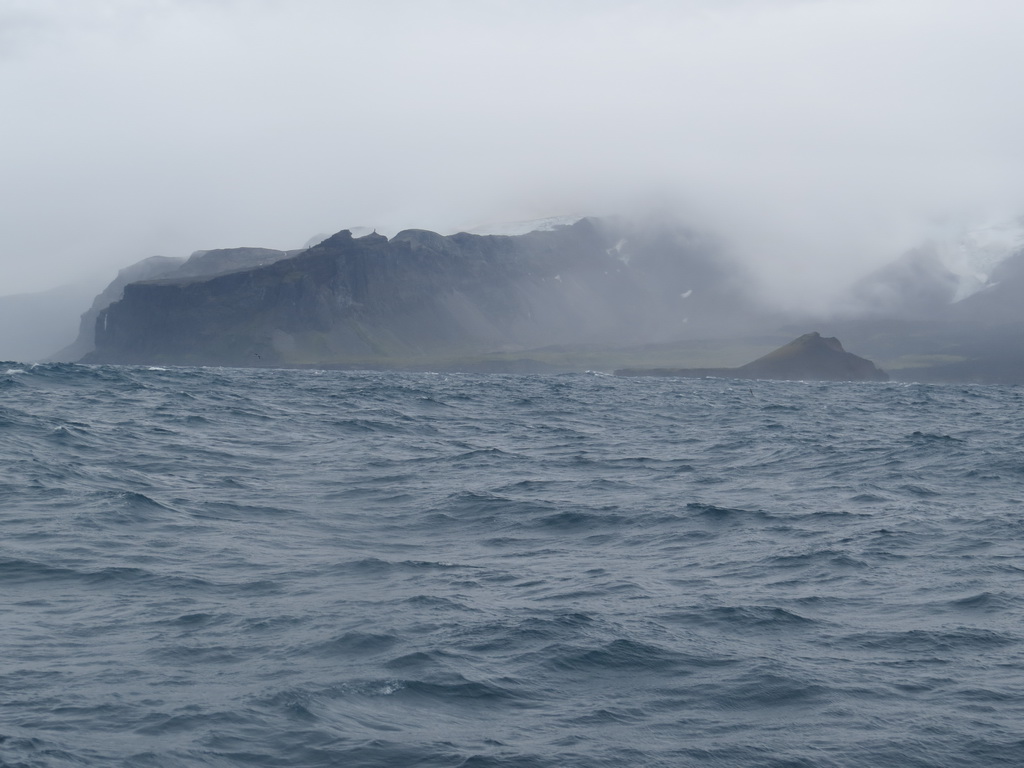
The crew of the Braveheart navigates in the fog to the place where Heard Island should be
|

|
A Heard Island Cormorant is a sure sign that the island is nearby
|
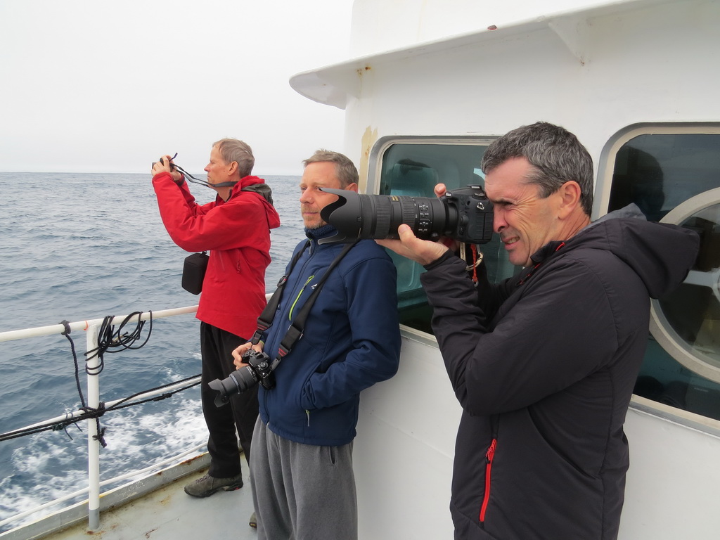
|
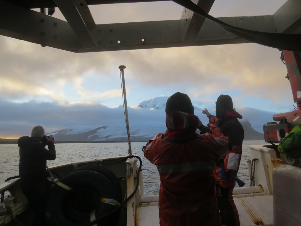
The expedition team competes for the first glimpse of the island
|
|
The entrance to the safe harbor appears out of the fog and mist
|
|
The crew and team get their first view of the9000-ft. volcano Big Ben
|
|
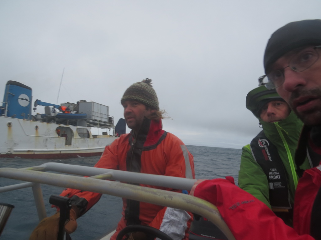
The crew carries the first team members to land
|
|
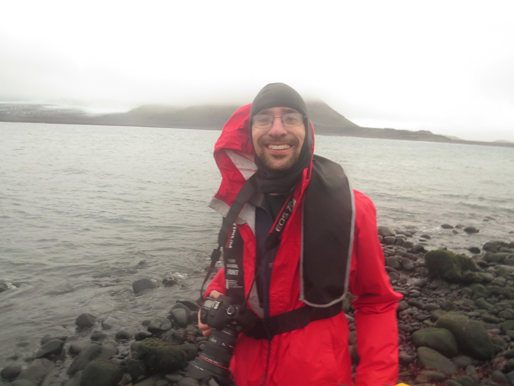
Bill Mitchell expresses his pleasure at (finally!) stepping on Heard Island
|

|
A break in the clouds and fog yields a breathtaking view of themountain, and some penguins on the beach
|
|
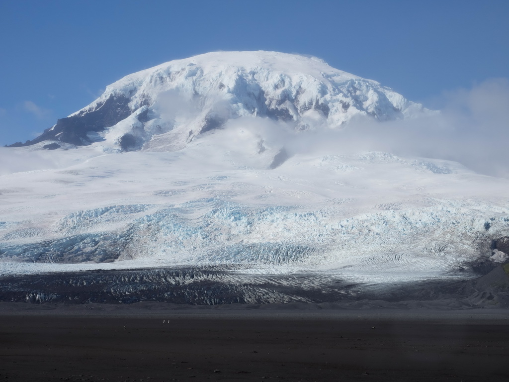
Big Ben in all its magnificence. Smoke and steam are rising from its summit, Mawson Peak
|

|
A telephoto image of Mawson Peak reveals its detailed structure for the first time
|
A QUIZ: "RECENTLY HEARD..."
March 5, 2017. Just for fun, we have generated a quiz to test (or demonstrate) your knowledge of the 2016 expedition to Heard Island. Here are the 12 questions. The answers are here.
- What was the callsign of the 2016 DXpedition to Heard Island?
- VKØHI
- VKØCQ
- VKØEK
- VKØIR
- Which vessel did the expedition use to get to Heard Island?
- Braveheart
- Marion Dufresne
- Agulhas
- Shokalski
- How many members of the 1997 VKØIR team were on the 2016 VKØEK team?
- 0
- 1
- 3
- 6
- How many days was VKØEK QRV?
- 14
- 16
- 18
- 20
- VKØEK logged the most QSOs on which band?
- 15m
- 20m
- 30m
- 40m
- What was the percent of CW QSOs for VKØEK?
- 14.5%
- 34.5%
- 54.5%
- 74.5%
- 95.5%
- Which continent logged the most QSOs with VKØEK?
- Asia
- Europe
- North America
- South America
- Australia
- Why didn’t VKØEK operate from Spit Bay as planned?
- The pileups would have been too high and there was no point
- The permit didn’t permit bringing the equipment to the site
- The surf was too high to safely land
- The team was tired and didn’t want to go to the trouble
- When was the VKØEK log posted online?
- One minute after each QSO was made
- Once each day, around 1800 UTC
- After the team returned, on April 15
- It hasn’t been posted online
- Why did the VKØEK DXpedition include scientific field work?
- Inclusion of the research was important to getting the permit
- The field work brought in about 20% additional funding and support
- Some members of the team joined the project because of the field work
- It was an opportunity to contribute to the understanding of climate change
- How many organizations and persons contributed to VKØEK?
- Less than 2000
- Approximately 5280
- Exactly 7583
- More than 11,000
- What is (are) the main expedition website(s)?
- www.heardisland.org and www.vk0ek.org
- www.heard.org
- www.cordell.org and www.DXpedition2016.org
- www.vkØek.com
|
1-YEAR REUNION EVENTS
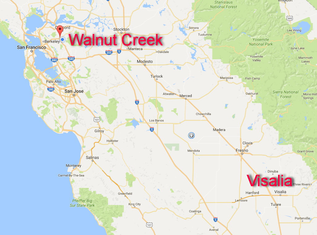 |
Feb. 1, 2017. We are coming up on the 1-year anniversary of the Heard Island expedition VKØEK. To celebrate the successful project, we have organized these events:
April 15, 2017 FIRST ANNUAL REUNION
Saturday April 15, 2017
Reunion
4:00-8:00 PM
Bob (KK6EK) and Kay Schmieder Home
4295 Walnut Blvd, Walnut Creek, CA 94596
(925) 934-3735
We’ll provide dinner and drinks and after-dinner entertainment. Open to anyone who made any kind of contribution (effort, money, advice, etc.) to the project, plus whatever guests you wish to bring. We’ll provide dinner at 5:00 PM, but you must RSVP to Kay: kericksonttt@yahoo.com
If you don’t RSVP you’ll have to stand around while the rest of us eat our dinner!
April 21-22, 2017 INTERNATIONAL DX CONVENTION
Visalia Convention Center
303 E. Acequia, Visalia, CA 93291
Information, 559-713-4000
The DX Convention: http://www.dxconvention.com
Saturday April 22, 2017
Open House
4:00-6:00 PM
Sierra Room A
A nice way to meet anyone who has interest in the Heard Island project for any reason. We’ll have a slide show or video running, and maybe some items for door prizes. No charge, and open to anyone.
Sunday, April 23, 2017
Presentation by Bob KK6EK: “The Future of DXing and DXpeditions”
4:00-5:00 PM
Main Ballroom
The talk will be based on the subject presented in the Jan/Feb 2017 issue of DX Magazine (Paper #6). The talk might generate some discussion; feel free to offer your opinion. |
HEARD ISLAND STARFISH IDENTIFIED
Jan. 15, 2017. During the expedition we collected seven specimens of one species of starfish. After detailed examination and some consultation, we have now identified it: Anasterias mawsoni (Koehler, 1920). This species was described from material from Macquarie Island, and is also known from Heard Island. T. D. O'Hara (Memoirs of Museums Victoria, Vol. 57, No. 2, pp. 167-223 (1998)) provides the following description of the species:
R to 62 mm, r to 15 mm. Arms 6, dorsally convex, ventrally flat, widest at base, tapering gradually to a blunt tip. Single madreporite, half to two-thirds from centre to intcrradial margin, small to large, sometimes inconspicuous, sometimes ringed by some spinelets. Anus inconspicuous, central. Ami furrows wide, 4 rows of suckcred tube feet. Dorsal skin thick and pustulate. Abactinal skeleton reticulate. Spinelets capitate, sometimes truncate, upper half spiniferous; often polygonal in cross section if in contact with adjacent spinelets; size variable, 0.4-1.1 mm dia, 1-2 times as high as wide; spinelets largest, widest on disc and proximal arm surfaces. Spinelets arranged in rows around aboard papular areas. Carinal plates form recognisable longitudinal row down arm; plates irregularly quadrilobed or rhombic, broadly imbricating. Spinelets distribution variable, from being densely clustered on plates, wilh up to 13 spinelets in 5 longitudinal rows, to scattered with as few as 2-A discrete spinelets. Dorsolateral skeleton variable, from strongly calcified with block-like imbricating plates to weakly calcified with thin bar-like or trilobed plates; forming transverse rows of up to 7 plates between carinals and superomarginals; forming 1-3 longitudinal rows, the row nearest the carinals most distinct; sometimes reticulate proximally. Dorsolateral plates with 0-3. usually 1-2, spinelets on raised section of plate: forming uni- or biserial rows transversely, with up to 12 spinelets present between carinals and superomarginals, forming irregular rows longitudinally. Papular areas with clusters of 4-8 papulae, single actinal papulae present between inferomarginal plates. Superomarginal plates from as long as to longer than wide, irregularly quadrilobed, long ventral lobe, shorter dorsal and lateral lobes, plates imbricate with surrounding plates. Superomarginal spinelets to 1 .0 mm in height, 2-2.5 times as high as wide, 2-7, usually 2-3, per plate. Inferomarginal plates forming actinolateral margin to arm, as wide as long, lobed, prominent oblique spine-ridge present centrally. Inferomarginal spines thick, capitate, slightly curved and terminally spiniferous or occasionally flattened and Oared; 2-5, usually 3~4, per plate, 2.5 mm high, 2.5-4 times as high as wide. Actinal plates barlike, wider than long, extend past half R, sometimes 2 series proximally, usually aligned with inferomarginals, with one spine, often confluent with, but smaller than inferomarginal spines. 6 adambulacral plates to every 2 inferomarginals. One adambulacral spine per plate, thinner, smaller than inferomarginal spines, 2.5 mm high, 4-5 times as high as wide, often club-shaped. On each jaw 2 oral and 2 suboral spines; oral spines often short. Straight pedicellariae present near mouth, in disc interradius, in arm furrows and amongst inferomarginals; size and distribution variable, sometime very numerous or scarce; some valves widened and truncate at tip; minority (typically 1 %) 3-valved, with additional small valve present at right angles to 2 primary valves. Crossed pedicellariae present marginally and dorsally. sometimes in high numbers. Macquaric Island population with separate sexes. Females brood juveniles under their discs by adopting an arching posture. Broods with up to 296 juveniles. Eggs mature in gonad from July to December until the eggs reach 2.0 mm diameter. Eggs are usually transferred to the brood in January-Febuary and released in May-June (Simpson, 1982). Two specimens in the present collection have brood juveniles in December and January. Colour. Live Macquarie Island specimens orange, tan, dark brown, purple or green on dorsal surface; spinelets and papulae often paler or different colour; dark stomach caeca visible beneath skin on smaller specimens. Ventral surface cream or white, spines pink or grey, tube feet tan. Habitat. Present on rock platforms under boulders, or in rock gutters, and subtidally (2-20 m) on sheltered sponges-bryozoan mats, on Codium. or under Macrocystis. McKnight (1984) reported several dredged specimens from 357 m. Distribution. Heard Island (0-30 m); Macquarie Island (0-357 m). Remarks. The six-armed Macquarie Island specimens of Anasterias are as variable as the fivearmed specimens described above under A. directa. The dorsal skeleton varies from being strongly calcified, with block-like plates and a dense covering of polygonal spinelets (pi. 2k), to a more open structure with thin bar-like plates and relatively few discrete rounded spinelets (pi. 2j). The former specimens were described by Koehlcr (1920) as P. sphoerulatus and the latter as P. mawsoni. However, there are numerous intergrades between these extremes. Koehler's other distinguishing character for A. sphoerulatus, the unusual three-valved pedicellariae, are present on most specimens. The different colour forms do not correlate with skeletal structure or spinelet density. Consequently, 1 refer A. sphoerulatus to the synonymy of A. mawsoni. This species is also common from the littoral of Heard Island. Heard Island specimens show a similar range of variation in the skeleton and spinelets. They also have some three-valved pedicellariae. A.M. Clark (1962) noted the reduced actinal series on BANZARE specimens from Heard Island. This is also a variable feature. Several specimens from Heard Island (NMV F73886) have a well developed primary actinal scries extending to the arm tip, and a second series proximally. The only other six-armed Anasterias species is A. perrieri (Smith, 1876) from Kcrguelen. This species appears to occupy a similar ecological niche at Kerguelen (McClintock, 1985) as A. mawsoni at Macquarie Island, but it differs from A. mawsoni in having thinner and less numerous spinelets. Specimens of A. perrieri that 1 have examined have no three-valved pedicellariae. A. mawsoni is not merely a six-armed form of A. directa. Besides the differing number of arms, the two species differ in the density of the abactinal spinelets, the colour, and the absence in A. directa of three-valved pedicellariae. There is also a time difference of four months between the peak release of brooded.
If you can read and understand this, you should have been on the expedition! We thank Dr. Tim O'Hara of Museums Victoria in Melbourne, Australia, for confirming the identification of this starfish.
|
DX MAGAZINE SPECIAL ISSUE - HEARD ISLAND 2016
Dec. 30, 2016. The new issue (January/February 2017) issue of DX Magazine is out. It contains six articles about the Heard Island Expedition:
PLANNING
THE EXPEDITION
RADIO OPERATIONS
INFOTECH
CHANGE
PERSPECTIVE.
This is a special (enlarged) editioni of the magazine, made possible by the cooperation and assistance of the editor Carl Smith N4AA.Carl has edited the magazine since 1997, the year of the previous Cordell Expedition to Heard Island.
If you are interested in DX Magazine, go to http://www.dxpub.com/DX-Magazine.html.
|
FINAL REPORT OF THE EXPEDITION RELEASED

Click on image to download [36MB PDF]
|
Nov. 9, 2016. The Final Report on the 2016 Cordell Expedition to Heard Island has been released.
Assembled by expedition organizer/leader Robert Schmieder, it contains the record of the operations and results of the expedition. It is organized in the following sections:
| 1. |
BACKGROUND |
| 2. |
PREPARATION |
| 3. |
THE VOYAGE |
| 4. |
OPERATIONS ON THE ISLAND |
| 5. |
FIELD RESEARCH ON THE ISLAND |
| 6. |
SPECIMENS |
| 7. |
INFOTECH |
| 8. |
AMATEUR RADIO |
| 9. |
ENVIRONMENTAL DATA |
| 10. |
LOGS |
| 11. |
EVIDENCE OF RECENT CHANGE |
| 12. |
SUMMARY OF RESULTS |
| 13. |
CONFORMANCE TO THE PERMIT |
| 14. |
RECOMMENDATIONS FOR FEATURE NAMES |
| 15. |
ACKNOWLEDGMENTS |
The Report is 264 pages long, with 710 figures (mostly photographs, plus a few diagrams). Numerous team members contributed material for the report, and several outside consultants, including Grahame Budd and Eric Woehler, edited and proofed the MS. It can be downloaded directly at the following URL:
http://www.heardisland.org/HD_documents/AAD_Final_Report/CE_HD_FINAL_REPORT_5.0.9.pdf
The Report is open to the public and is provided at no charge. However, it is copyrighted, so any use of any content in another publication or for any other purpose must have written permission from Cordell Expedition. Please credit any citation or othr use to Copyright (c) 2016 Cordell Expeditions.
|
IMAGE ENHANCEMENT PRODUCES STUNNING PICTURE
OF MAWSON PEAK
Oct. 30, 2016. Using a series of enhancement steps, we have recently been able to optimize some of our photographs of the peak of Big Ben, called Mawson Peak. he stunning image shows a 25-m rim on the peak that is emitting steam and smoke. The edifice has grown vertically at least 45m in the past two decades, evidenced by photographs taken during the VKØIR expedition in 1997. The image above was taken from the southern edge of the Laurens Peninsula, across Atlas Cove opposite the 2016 expedition campsite.
A full-size (1930x1139) image can be downloaded by clicking on the image above.
|
WIDE ANGLE PHOTOGRAPHS PROVIDE SPECTACULAR VIEWS
OF HEARD ISLAND
Oct. 21 2016. Recently we have been organizing and processing some of the more than 25,000 photographs we obtained on the expedition. Among them is a set of wide-angle pan photos that provide spectacular views ot eh area around the campsite at Atlas Cove .
These photographs have resolution around 10,000x2500px. They are JPG files ranging in size from 3MB to 18MB. We post here 4 of these high-resolution pictures. You can download the full-resolution image by clicking on a thumbnail above. The library contains more of these images, which are being used for documentation of the overall conditioins of theisland at the time of the expedition.
Please credit these pictures to "Cordell Expeditions 2016 Heard Island Expedition, courtesy R. W. Schmieder".
|
MAJOR EROSIVE EVENT ISOLATES THE TIP
OF THE LAURENS PENINSULA
 |
 |
 |
 |
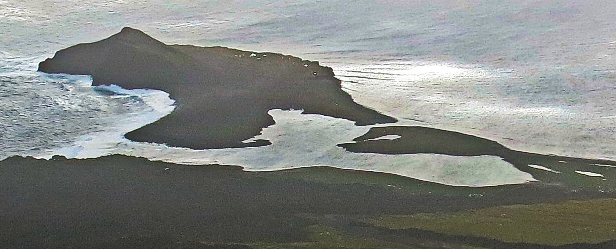
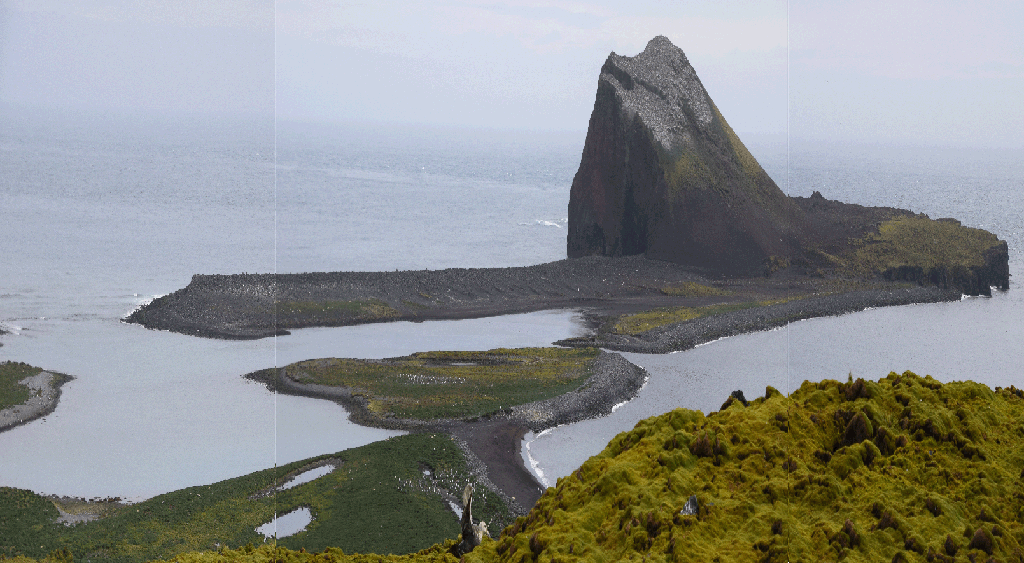
The isthmus between Red Island and the rest of the Laurens Peninsula. (Top) Photo taken 2 April 2016 by Fred Belton. (Upper) Image taken 2 April by Fred Belton (stretched vertically 2.5X. (Middle) Detail of the narrow channel cut through the isthmus. (Lower) Satellite image taken 2006 (source Google Earth), tilted to roughly match the view of the upper image.
|
Oct. 16, 2016. The 2016 Cordell Expedition team has documented a major change on Heard Island: a breach of the the isthmus joining the main body of the Laurens Peninsula with Red Island. A continuous channel across the isthmus has been cut in less than 10 years. This channel was navigated by the service boat that landed Fred Belton and Gavin Marshall on this location for a 4-day stay starting March 30, demonstrating that it is not a wind-swept floodplain, but rather a permanent channel.
The two images above show the dramatic change over the past decade. The upper image, a composite of three 2016 photographs that has been stretched vertically to approximate a higher viewpoint, shows that the channel extends completely across the isthmus. The lower image is from 2006 (Google Earth); it has been tilted to approximate the viewpoint of the upper image. This image shows a 3-lobed lagoon surrounded by breakwaters no more than 3m high. It is obvious that the channel, at least partially, has been cut joining the ocean with the lagoon.
Since 1874, the prominent rock, about 40m high, has been referred to as "Red Island." It is not, however, obvious that it was ever an island; we cannot find any reference to it being cut off from the rest of the Laurens Peninsula. The 2006 images show that at that time the isthmus was at most 3 m high, hence it is possible that over the past 150 years it has at times been cut through by a channel like the one we now see. Regardless of the history, the current existence of the channel fully justifies the use of the term Red Island. |
VENT EDIFICE PREDICTED TO RISE TO
HIGHEST POINT
ON HEARD ISLAND
Oct. 14, 2016. A recent detailed study by Expedition Leader Robert Schmieder of photographs taken at Heard Island during the 2016 expedition has revealed a surprising fact: Heard Island soon may have a different official elevation.
The highest point on Big Ben is called Mawson Peak, officially 2,745m above sea level. However, in 1997 the VKØIR team saw smoke and steam coming from a vent in this location, but the vent itself was not visible. From calibrated photographs taken by the author in 1997 and 2016, the vent originated from an apparent elevation lower than 2,720m, i.e., at least 25m lower than the listed elevation of Mawson Peak. (This elevation is the apparent elevation of the shoulder at the vent as seen from the campsite near the ANARE station). In 1997 no vent edifice was visible above the shoulder, but in 2016 the vent comprised an edifice about 25m in diameter and some 45m higher than the visible shoulder. That is, this edifice apparently has grown by this amount in 19 years.
A significant eruption was observed in January, 2016. The lava flow was on the south side of Big Ben, away from the view from the 2016 Cordell Expeditions campsite. |
QST ARTICLE WINS COVER AWARD
 |
QST Magazine Oct. 2016
|
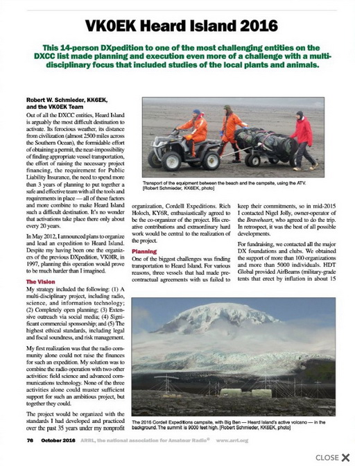
Oct. 12, 2016, 2016. We are pleased to announce that the VKØEK article, shown on the cover of the October issue of QST (see below), has received the cover plaque award. The QST announcement can be seen here:
http://www.arrl.org/news/view/kk6ek-wins-october-qst-cover-plaque-award.
by KK6EK and the entire VKØEK team. We are
particularly proud that the entire team is honored by this award, since the entire team contributed to it. We thank Steve Ford, WB8IMY, QST Editor, for making the production of this article a pleasure.
|
EXPEDITION CONTINUES OUTREACH WITH PRESENTATIONS
AT MAJOR DX MEETINGS
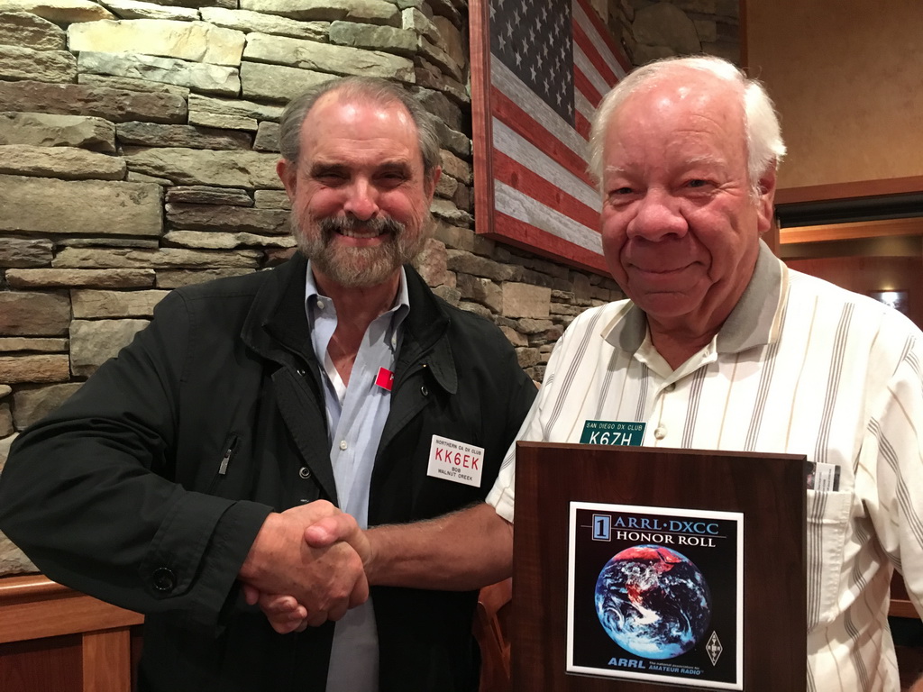 |
Expedition Leader Bob KK6EK congratulates DXer Jim Price K6ZH, a member of the San Diego DX Club, on reaching ARRL DXCC #1 Honor Roll. Jim logged 4 QSOs with VKØEK.
|
    |
Sept. 28, 2016. The VKØEK team is continuing its outreach efforts in presentations at DX conventions and club meetings. The first presentation was at IDXC Visalia in April 2016, while the DXpedition was still in progress. By prior arrangement, the presentation was made by co-organizer Rich KY6R. Bob KK6EK called in on a satphone and was patched to the audience at the Saturday evening banquet. We believe this was the first time a working DXpedition had made a live appearance at the IDXC.
Several of the expedition participants have given presentations to local clubs. In the past 2 weeks Bob made trips to the following conventions: W9DXCC Chicago, IL;
SEDXC Roswell, GA;
W4DXCC Pidgeon Forge, TN; and
SDDXC San Diego, CA. At the last of these, DXer Jim Price K6ZH arrived with his plaque showing he had obtained DXCC Honor Roll #1. Jim provided these words to commemorate the event:
The Last One by Jim Price, K6ZH
I've been a ham since I was a kid (novice in 1963), but I didn't get started chasing DX much until the 1970s, and not seriously until the 2000s. I could see that working them all was a possibility as I have a reasonably good station (2 elements on 40, a 4-element SteppIR, and 30 meter rotary dipole, all at 60 feet). By 2013, I had worked 'em all, EXCEPT for one - Heard Island. So I kept saying to my fellow hams, "I have to live at least long enough to work the last one!"
At first the Heard operation was going to be in 2014, then in 2015, and finally, there they were, on their way to Heard in March 2016. Early in the morning (CA time) on March 24th, I worked VK0EK on 30 meter CW in just a couple of calls. Woo Hoo - there it is! And when I saw my call come up on their web page I was like - WOW! I then had a trip away from home for a few days. When I returned, I managed 3 more QSOs: 40 CW on April 1, 20 CW on April 8, and 40 SSB on April 9 - the last day. The 30 meter QSO was quick with fairly loud signals. The others were a couple of S-units above ESP!
So, thanks Bob KK6EK and the multitude of others!! I have the #1 Honor Roll plaque on the wall, I enjoy my morning tea in a VK0EK coffee mug, and I have the satisfaction of finishing the longest project of my life! |
Jim's story has been matched by numerous DXers who come to us at these meetings and recount their specific experiences. We are pleaseed to have been able to move these DXers up a notch, and for many of them, to the top rung on the ladder. Congratulations to all who logged VKØEK!
|
ARTICLES ON VKØEK FEATURED IN MAJOR RADIO MAGAZINES
 |
 |
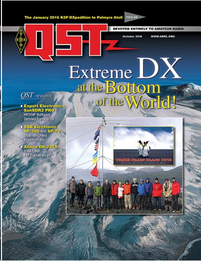
QST Magazine Oct. 2016
|
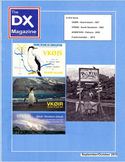
DX Magazine Sept/Oct 2015
|
Sept. 20, 2016. We are pleased to note that two of the major ham radio magazines are featuring theHeard Island expedition. The October issue of QST carries the cover story of VKØEK, the counterpart to the 1997 VKØIR cover story.
The January/February issue of DX Magazine will be devoted entirely to the Heard Island expedition. It is expected that the issue will carry six articles, each about 4 pages long. Subjects to be covered are:
PLANNING
THE EXPEDITION
RADIO OPERATIONS
SCIENCE OPERATIONS
IT OPERATIONS
RETROSPECTIVE
The articles will have multiple authros, some participants and some non-participants.
VOTE FOR THE QST COVER ARTICLE!
QST will award a plaque for the best article in the October issue. If you are an ARRL member, you can vote for the article of your choice. We hope you will vote for theVKØEK article. Please go HERE to vote for the VKØEK article!
|
|
| |
TEMPERATURE AND ILLUMINATION PROBES SHOW
DETAILS
OF THE DIURNAL CYCLE ON HEARD ISLAND
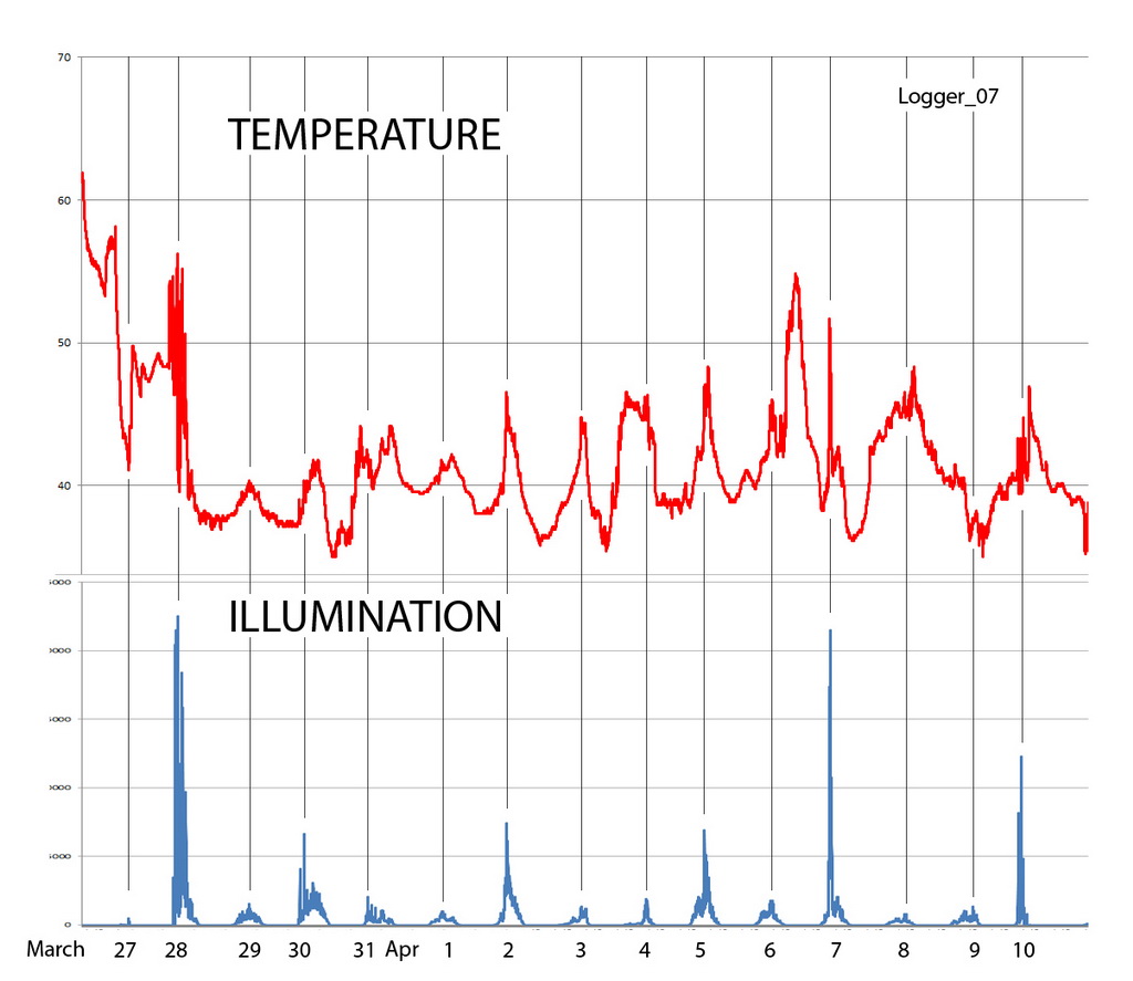 |
Temperature recorded by one of the five sensors (Logger_07_1043_1966) deployed during the Heard Island Expedition. The temperatore scale runs from 34 degF to 70 degF. The illumination scale runs from 0 to 2400 lum/sq-ft.
|
 |
The average temperature of the days March 28-April 8, 2016, as a function of time of day, computed as the average of the probes.
|
 |
A parametric plot of the temperature vs illuminance recorded by sensor Logger_07_1043_1966 on April 6, 2016. The plot shows clearly that the temperature rises after sunup almost monotonically with the illuminance (with some fluctuations), and then falls as the illuminance returns to zero at sundown. For more discussion of these data, read the comments below.
|
Sept. 18, 2016. During the 3-week stay on Heard Island, we deployed five temperature/illuminance sensors in five selected locations around Atlas Cove. The HOBO probes from ONSET (shown at right) were set to make recordings once per minute over the duration of the stay. Recently we have obtained readouts of the probes; each had recorded 28,953 pair of values, for a total of 144,765 measurements.  Typical data from these probes is shown in the plots above. Typical data from these probes is shown in the plots above.
The upper plot shows the temperature and illuminance as a function of time. These data clearly show that the temperature peaks correlate closely with the illuminance peaks. This is quite reasonable: sunlight warms the island (and the probes). Close inspection of the data shows two interesting features: (1) The temperature peaks show a (slight) lag after the peak illuminance, with a somewhat extended tailing off after the peak; (2) The illuminance peaks do not occur at precisely the same time each day. The lag is consistent with the fact that the probes have thermal mass, hence take some time to respond to the changes in illuminance during the day. The jitter in peak illuminance (typically and hour or so) could be associated with overcast. After all, most days on Heard Island are cloudy.
The middle plot above shows the average temperature during a 24-hour day (0000-2399 hrs). This curve indicates that the peak temperature occurs around 1:00 PM. There is a suggestion of breaks around 0630 hrs (6:30 AM) and 2000 hrs (8:00 PM), which we might associate with sunrise (6:28 AM) and sunset (17:52) on Heard Island.
The bottom plot above displays the relationship between the illuminance and the temperature. Overall, the temperature was rising on that day, and eventually it rose relatively high. However, the relatively brief period of sunshine warmed the probe, which then cooled off after the illuminance dwindled. We interpret this plot are follows: A warm weather front was approaching during the night, causing the temperature to rise, even in the darkness. As the sun rose, the temperature rose faster than the warm front rise, causing the temperature to rise almost linearly with the illuminance. As darkness returned, the temperature cooled, returning to the value determined by the warm front. During the night the temperature continued to rise. Similar patterns are seen for the other days, that is, a major temperature change associated with weather fronts, modulated by the diurnal heating during the day.
An interesting result that emerges from the illumination sensors is that the average peak values are around 5300 lum/ft2, which converts to about 60 W/m2. The highest values seen during our stay were around 22,000 lum/ft2 or around 250 W/m2. The total solar irradiance on a clear day at sea level is about 1000 W/m2. The latitude cosine factor is about cos(53°)=0.6, hence the irradiation at the latitude of Heard Island should be about 600 W/m2. Instead, what we see is about 40% of that value. Thus, Heard Island, at least during our stay, was seeing slightly less than half of the expected solar irradiance, which could reasonably be associated with atmospheric absorption. Of course, some days were overcast or cloudy which significantly reduced the peak illumination, typically to about 10% of the expected value.
We thank Dr. Steve Smith of OceanEarth for these probes, and for assistance in extracting the data and in clarifying the calibration of the sensors. |
WATER SAMPLES INDICATE THAT HEARD ISLAND GLACIERS
CAN CONTRIBUTE TO OCEAN ACIDIFICATION
 |
 |
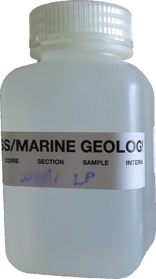
Sample of Heard Island glacial water
|
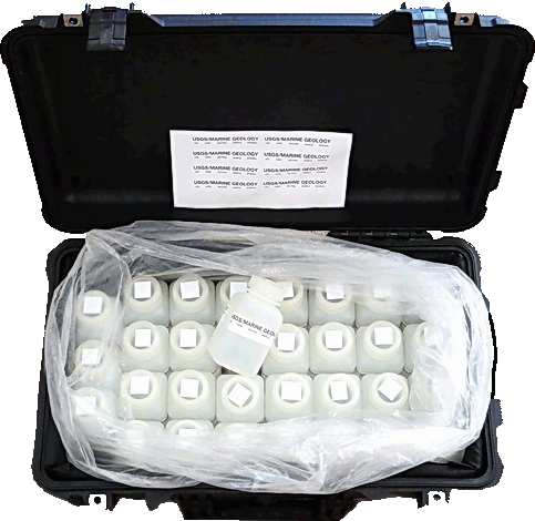
Collection of water samples
|
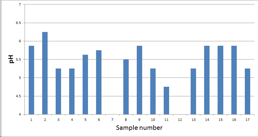 |
pH of the 15 water samples from Heard Island. The left group of 6 is from the Laurens Penisnula. The middle group of 4 is from the Nullarbor region of Atlas Cove. The right group of 5 is from Stephenson Lagoon, on the eastern tip of Heard Island. The average pH for all 15 values is 5.57.
|
Sept. 15, 2016. A preliminary examination of the water samples collected during the Heard Island expedition yielded a strong indication that the melting of the glaciers produces acidic water that flows directly into the oceans. This is consistent with evidence of the acidification of the ocean by worldwide absorption of carbon dioxide, which produces carbonic acid. Acidification in turn damages sensitive organisms such as corals, that live in a very narrow range of the chemical state of the oceanic water.
One standard measure of water chemistry is pH. It is a simple number that indicates whether the water is acidic or alkaline. A pH of 7.0 is exactly neutral; lower values means the water is acidic, higher values means it is alkaline. A change of 1 unit in pH means a 10-fold change in the concentration of ions.
The 2016 expedition team collected water samples from glacial streams, lagoons, and glacial ice. The plot above shows the average values of the pH for these samples. The samples all show pH values in the range 5-6, even though they are from three distinct regions of Heard Island. These pH values are about the same as black coffee and Pepto Bismol, but significantly higher (less acidic) than tomato juice and significantly less (more acidic) than urine and saliva. The Heard Island values are significantly lower (more acidic) than normal continental stream values.
These measurements are consistent with the fact that most of Heard Island is volcanic rocks, while very little is calcium-rich strata such as limestone. Limestone would increase pH (make it less acidic). The average values of pH for the three groups above are 5.67 (Laurens), 5.33 (Nullarbor), and 5.63 (Stephenson). While the statistics are not strong, there is a slight indication that the Nullarbor is the most acidic of the three regions. Whether this is due to geology or biology is not yet clear.
While the amount of oceanic acidification due to Heard Island alone is extremely small, these measurements are consistent with the observations that its glaciers are producing (slightly) acidic water. Across the globe, such processes are projected to have a major impact on the biosphere and resources that derive from, and depend on, the chemistry of the ocean. |
ROCK AND SEDIMENT SAMPLES CONTRIBUTING TO THE
UNDERSTANDING OF HEARD ISLAND GEOLOGY
Sept. 7, 2016. The specimens of rocks and sediment collected during the expedition are being examined. At the University of Tasmania, PhD candidate Jodi Fox and faculty member Prof. Patrick Quilty have provided an overall description and images of the rocks, while Expedition Leader Bob Schmieder is working through the sediment samples.
In spite of Heard Island being a volcano, the specimen collection includes some limestone samples, which are sedimentary rocks, although they are only a tiny fraction of the predominantly basaltic volcanic deposits. Ms. Fox notes that in some of the rocks they "can see some microfossils which may be important for dating the island (and more regional events such as sea level changes)." She also says that Prof. Quilty is "going to examine them further under microscope and then get them thin sectioned to see what he can see micro- and nano- fossil wise."
The sediments are mostly mixed dark volcanic sand, ranging from large pebbles to microscopic grains which form deposits of "glacial flour." Originally the samples were preserved in alcohol to prevent decomposition. In the lab they are washed several times in alcohol and air-dried, after which they are put through a 7-stage sieve stack with standard meshes 5, 10, 35, 60, 120, and 230. The 7 fractions that are retained in the 6 sieves plus bottom pan are then weighed and stored in glass jars. Samples of each fraction are then put through an ultrasonic alcohol bath to remove electrostatically adhering dust, and again air-dried. Then they are examined and photographed using a macro cameras for the large grains and a dissecting microscope for the small grains. Preliminary examination of the samples shows clear differences between them, in size, color, texture, and crystallinity. |
STATISTICS OF RADIO OPERATION SHOW EFFECTS OF PROPAGATION
|
Aug. 25, 2016. Team member Bill Mitchell AEØEE has compiled the statistics of the VKØEK DXpedition, presented here in two tables. The first table shows the number of QSOs as a function of band/mode, while the second table shows the number of QAOs as a function of band/continent.
| Heard Island VKØEK 2016 |
| MHz |
CW |
RTTY |
SSB |
Totals |
% |
| 1.8 |
3225 |
0 |
13 |
3238 |
4.3 |
| 3.5 |
5902 |
0 |
0 |
5902 |
7.9 |
| 7 |
8956 |
1279 |
1562 |
11797 |
15.7 |
| 10 |
9898 |
933 |
0 |
10831 |
14.4 |
| 14 |
5774 |
0 |
3238 |
9012 |
12.0 |
| 18 |
7047 |
0 |
2957 |
10004 |
13.3 |
| 21 |
7643 |
1183 |
4498 |
13324 |
17.8 |
| 24 |
5015 |
0 |
2342 |
7357 |
9.8 |
| 28 |
2419 |
1 |
1149 |
3569 |
4.8 |
| Totals |
55879 |
3396 |
15759 |
75034 |
|
| Heard Island VKØEK 2016 |
| MHz |
AF |
AS |
EU |
NA |
OC |
SA |
UNK |
| 1.8 |
24 |
483 |
2376 |
293 |
56 |
6 |
0 |
| 3.5 |
50 |
922 |
3410 |
1383 |
104 |
31 |
2 |
| 7 |
132 |
1789 |
6420 |
3205 |
167 |
81 |
3 |
| 10 |
63 |
1488 |
4807 |
4165 |
211 |
94 |
3 |
| 14 |
207 |
2160 |
3268 |
2680 |
628 |
68 |
1 |
| 18 |
153 |
3508 |
4842 |
952 |
383 |
153 |
13 |
| 21 |
206 |
3315 |
7789 |
1344 |
353 |
316 |
1 |
| 24 |
98 |
2285 |
4308 |
475 |
112 |
76 |
3 |
| 28 |
48 |
1126 |
2277 |
82 |
29 |
6 |
1 |
| CW |
456 |
12221 |
30626 |
10901 |
1097 |
554 |
24 |
| RTTY |
36 |
663 |
1389 |
1182 |
71 |
54 |
1 |
| SSB |
489 |
4192 |
7482 |
2496 |
875 |
223 |
2 |
| Totals |
981 |
17076 |
39497 |
14579 |
2043 |
831 |
27 |
| % |
1.3 |
22.8 |
52.6 |
19.4 |
2.7 |
1.1 |
0.0 |
The following plots show the number of QSOs as a function of frequency, time of day (UTC), and date-time.
Several aspects of these data show the effects of propagation. The most obvious of course is the diurnal (daily) cycle as the path moves into and out of daylight. The distribution of QSOs vs frequency shows why the bands 15-40 m are the most useful. The peak rate was around 1000-1200 UTC, and there were two minima, around 1500 UTC and 0000 UTC. What is less obvious is the reduction in rate around April 4 and April 8-11. These periods were not deficient because of lack of effort--the team was active on all bands and modes and all day/night. Unfortunately the propagation declined during the this week, as described by the ARRL Propagation Broadcast Bulletin 15 (April 8, 2016) prepared by K7RA (http://www.arrl.org/w1aw-bulletins-archive/ARLP015/2016) [excerpts]:
QST de W1AW
Propagation Forecast Bulletin 15 ARLP015
From Tad Cook, K7RA
Seattle, WA April 8, 2016
All solar and geomagnetic indicators declined again last week.
Compared to the previous seven days, from March 31 through April 6
the average daily sunspot number slipped from 28.1 to 19.4. Average
daily solar flux sank from 88.8 to 83.1, while average daily
planetary A index went from 11.9 to 9.4. Average daily mid-latitude
A index went to 7.6 from 8.6.
The big factor in bringing the week's average sunspot number down
nearly 9 points was the fact that the daily sunspot number was 11 on
March 31 through April 2. 11 is the lowest sunspot number we can
possibly observe, unless there are 0 sunspots, then the sunspot
number is 0. Each sunspot group is counted as 10 points, and these
are added to the total number of sunspots which count as one each,
so a sunspot number of 11 is what you get with just one sunspot
visible.
Spaceweather.com reported early Thursday that on April 7, Earth is
expected to cross a fold in the Heliospheric Current Sheet, which
could trigger unsettled geomagnetic conditions.
The Heliospheric Current Sheet separates regions of solar wind where
the magnetic field points toward or away from the Sun. See
http://bit.ly/25MG4lW for a continuous animation of this effect from
2001 until 2009. See https://en.wikipedia.org/wiki/Heliospheric_current_sheet for
more information.
Sure enough, early on April 8 at 0007 UTC the Australia's Space
Weather Services issued a geomagnetic warning:
"The geomagnetic conditions are currently at minor storm levels and
are expected to remain at these levels for the next 6-12 hours. This
is a combined effect of sustained strongly southwards IMF Bz (see
http://bit.ly/1S6H68D ) starting from 07/1800 UTC but with stable,
weak solar wind speeds (380 km/s). However, the solar winds are
expected to gradually increase later today in response to a small
recurrent southern hemisphere coronal hole moving into a
geo-effective location on the solar disk. The aurora may be visible
from as low as some parts of the state of Victoria, Australia, on
the local night of 8 April. Increased geomagnetic activity expected
due to a coronal hole high speed wind stream from 08-09 April 2016."
Sunspot numbers for March 31 through April 6 were 11, 11, 11, 38,
23, 27, and 13, with a mean of 19.1. 10.7 cm flux was 81.7, 82.1,
81.5, 82.3, 83.4, 83.4, and 87.1, with a mean of 83.1. Estimated
planetary A indices were 7, 3, 22, 15, 7, 5, and 7, with a mean of
9.4. Estimated mid-latitude A indices were 5, 2, 15, 13, 6, 5, and
7, with a mean of 7.6. |
Expedition co-Organizer Rich KY6R used VOACAP to make signal-strength predictions for his QTH (Orinda, CA):
Dean N6BV produced tables of signal strength for Zones:
Comparing the Heard Island Expedition data with the various model predictions and the solar observations shows clearly why it was very difficult to hear, and be heard by, VKØEK especially during the first week of April, 2016. We look forward to more detailed quantitative analysis of the VKØEK data; perhaps it will reveal additional understanding of the behavior of radio waves from the subantarctic islands.
|
CARGO ARRIVES FROM AUSTRALIA--DISTRIBUTION WILL
COMPLETE THE LOGISTICS FOR THE EXPEDITION
 |
 |
 |
 |
 |
 |
| (Above) The cargo (finally!) arrives from Fremantle, Western Australia. Top row: Pat Sylvester unloads the ATV and the first of 16 shipping cases which were first used on the 1997 Heard Island Expedition. Middle row: The cases are opened, and team members (Dave Farnsworth WJ2O, Carlos Nascimento NP4IW, and Dave Lloyd K3EL) begin the processof repacking thecontents into the orginal coartons for reshipment. Bottom row: Safely in the expedition warehouse, the cargo looks a lot like it did when it left the previous November. Team members Fred Belton KM4MXD and Ken Karr NG2H pay a visit to Mt. Diablo, the nearly 4000-ft. peak, from which one can see San Francisco and the Farallon Islands, about 80 miles distant. |
|
|
Aug. 19-21, 2016. After more than 4 months, the cargo from the Heard Island Expedition arrived in Oakland, California, and was put into the warehouse.
Some key items intentionally were not included in the shipment: The Airbeam shelters were reclaimed by HDT Global in Fremantle, relieving us of shipping the back to Virginia. The bunk beds, a gift from Disc-O-Bed, were gifted to the Braveheart as a thank you to the team for their exceptional service. The rock specimens were shipped directly to Jodi Fox at the University of Tasmania. The water and soil specimens were shipped to California separately. The shipment did include the ATV, all the radios, amplifiers, antennas, and two generators, as well as the emergency and medical supplies, scientific equipment such as microscope, weather instruments, the flags, paperwork, and various personal clothing and gear.
Over the weekend, several members of the team got together to sort the items into piles for final destinations. That evening, Expedition Leader Bob Schmieder presented a program of 361 slides showing the entire project from beginning to end. It was slightly more than 1% of the total of more than 30,000 images that the expedition generated, including 25,000 of Heard Island. |
ANALYSIS BEGINS ON HEARD ISLAND SPECIMENS
|
|
|
July 31, 2016. With the arrival of the water and soil specimens from the Heard Island expedition, we are able to being examination and characterization of the collection. The water samples have not yet been opened, pending controlled chemical analysis. The majority of the soil samples are actually volcanic sand and gravel, with minor portions of organic matter. The latter are being washed in ethyl alcohol (ETOH), air dried, and sieved for particle size separation. We are dividing the sediment into mesh 5, 10, 35, 120, 225, 370, and finer components.
The organic constitutents include various sub-rounded black grains and pebbles and subhedral crystals, typical of glacial till. The grains have density about 2.0 The majority of the black grains are likely augite, magnetite, and hornblende. The transparent crystals, which are smaller than about 1 mm, are likely weathered olivine. A common fibrous plant found in several of the specimens has twisted tufts 1-2 cm long; it is as yet unidentified.
One live insect was found and collected. Because it was walking on the ground, it was at first thought that it might be an ant, in spite of the fact that no ants are known from Heard Island. However, careful examination with the microscope showed it to be the wingless fly Anatalana aptera, a known resident of Heard Island (and Kerguelen Islands). The specimen is difficult to distinguish from another species A. crozetensis, known from Crozet Island. These species were defined in 1875 by A. E. Eaton. |
INMARSAT GOVERNMENT ANNOUNCES EXPEDITION SUPPORT

|
| Heard Island team member Bill Mitchell tends the satellite link to the internet, enabled by Inmarsat BGAN 710 terminals, seen at his left. One terminal was dedicated to the radio operations, providing real-time online updates of the radio log. The other terminals were used for administration aand personal communications. The terminal speed was sufficient to enable several first-time innovations, including Skype calls and remote radio operation. |
|
June 3, 2016. Inmarsat Government today released the following Announcement:
|
Inmarsat Government Connects Antarctic Heard Island Expedition
Inmarsat’s BGAN Satellite Services Play Critical Role in Success of Expedition by Delivering Highly Reliable Communications Support in Extreme Remote Polar Region
Inmarsat Government, a leading provider of secure, global, mission-critical telecommunications to the U.S. government, today announced that it has successfully supported the 2016 Heard Island Project, a multidisciplinary expedition to a remote island in the Southern Ocean.
The purpose of this three-week expedition, undertaken by Cordell Expeditions, a nonprofit research organization based in northern California, is to provide new information about Heard Island’s harsh volcanic environment and to validate satellite communications in severe, and extremely isolated, environments in the Antarctic.
The Heard Island Project’s goal is to bring technology to challenges of worldwide need and interest. The results from this expedition will help scientists better understand the effects of climate change in polar regions and the ability of models to predict the consequences of actions or inactions in facing this challenge.
Other areas of focus included: searching for unknown species that may have been revealed by recent major glacial retreat; confirming the group’s recent discovery of subterranean rivers carrying glacial meltwater; documenting plastic debris from sources worldwide; and collecting samples of the environment that are expected to contain cryptobiota – organisms that have the ability to suspend metabolism for years or decades in the face of extreme conditions of cold, heat, desiccation or toxic chemicals.
Inmarsat Government provided satellite communication services used to enable radio propagation analysis, TV broadcasts, video secondary school classroom education, video communication and blogging. During the expedition, Inmarsat’s reliable and easy-to-use Broadband Global Area Network (BGAN) service kept worldwide followers updated promptly of expedition activities. Inmarsat Government provided terminals and managed communication services to support the base station and remote scientific teams collecting samples and important documentation of the environment including its unique flora and fauna.
Inmarsat’s BGAN service played a key role in the expedition’s radio science (medium frequency (MF) and higher frequency (HF) propagation experiments) as they contacted over 75,000 other stations during unusual solar geomagnetic conditions. It also enabled reliable communications with the science teams when they travelled to a number of areas remote from the base camp to gather samples (that will go to universities for analysis of lava content, biota, glacier stream chemical composition and more) and conduct high resolution ("Gigapan") photography of the many unusual features here.
“Inmarsat Government’s support helped advance the use of satellite communications from this extreme, isolated, environment in the sub-Antarctic region. The availability and reliability of Inmarsat’s satellite communication services enabled a qualitatively better capability for the expedition to communicate its activities to the general public, ensure safety, and provide for real-time interactive scientific collaboration,” said Kenneth Karr, Heard Island Expedition. “In particular, it helped facilitate conferencing for scientific collaboration and emergency response, and the ability to upload archival images and data in the most challenging weather conditions that included high winds, driving snow, sleet and volcanic grit that blows with the wind – at times reaching 80 mph.”
The group carried out a major amateur radio operation using the call sign VKØEK. Unlike any other similar amateur radio operation, the Cordell Expeditions group developed a unique technology that enables near real-time internet display of the radio operations. The system, called DXA, uploads the radio log data through Inmarsat satellites to an internet server once per minute, providing viewers with an almost real-time graphical interface to the expedition. DXA was first deployed on an expedition to Kure Atoll in the Pacific in 2005 and then on a second expedition to Clipperton Island in 2013, On both of those expeditions, the DXA website received 40 million hits, attesting to its popularity and the value of real-time data from the expedition. The latest version (DXA3) was deployed on Heard Island; it can be seen on line now at http://dxa.vk0ek.org.
“Supporting this expedition further demonstrates that Inmarsat’s services are best-in-class when it comes to delivering dependable ‘on-the-move’ communications – in any location or weather condition,” said Gabe Venturi, Chief Commercial Officer, Inmarsat Government. “No matter where they are on the map, users seek highly available connectivity for reliable access to the information and services essential for mission success. It has been a privilege to support the Heard Island Expedition and do our part in further advancing scientific exploration.”
For more information about the Heard Island Expedition please contact the expedition Organizer/Leader Dr. Robert Schmieder, at schmieder@cordell.org.
For further information
About Inmarsat Government
Inmarsat Government is a leading provider of secure, reliable and affordable mission-critical telecommunications to U.S. military, intelligence and civilian organizations. Equipped with the industry’s leading satellite and terrestrial infrastructure, it delivers custom, end-to-end networks and solutions that can sustain communications anytime, anywhere. Inmarsat Government, a wholly-owned subsidiary of Inmarsat plc, and an authorized Value Added Reseller (VAR) for Inmarsat Global Xpress, is responsible for Inmarsat’s retail U.S. government business. It is headquartered in Reston, VA, with network assets and operations around the globe.
About Inmarsat
Inmarsat plc is the leading provider of global mobile satellite communications services. Since 1979, Inmarsat has been providing reliable voice and high-speed data communications to governments, enterprises and other organizations, with a range of services that can be used on land, at sea or in the air. Inmarsat employs around 1,600 staff in more than 60 locations around the world, with a presence in the major ports and centers of commerce on every continent. Inmarsat is listed on the London Stock Exchange (LSE:ISAT.L). For more information, please visit www.inmarsat.com. The Inmarsat press release newsfeed and corporate updates are on Twitter @InmarsatGlobal.
| “No matter where they are on the map, users seek highly available connectivity for reliable access to the information and services essential for mission success. It has been a privilege to support the Heard Island Expedition and do our part in further advancing scientific exploration.” |
|
|
A SPECIAL MESSAGE FROM THE EXPEDITION LEADER
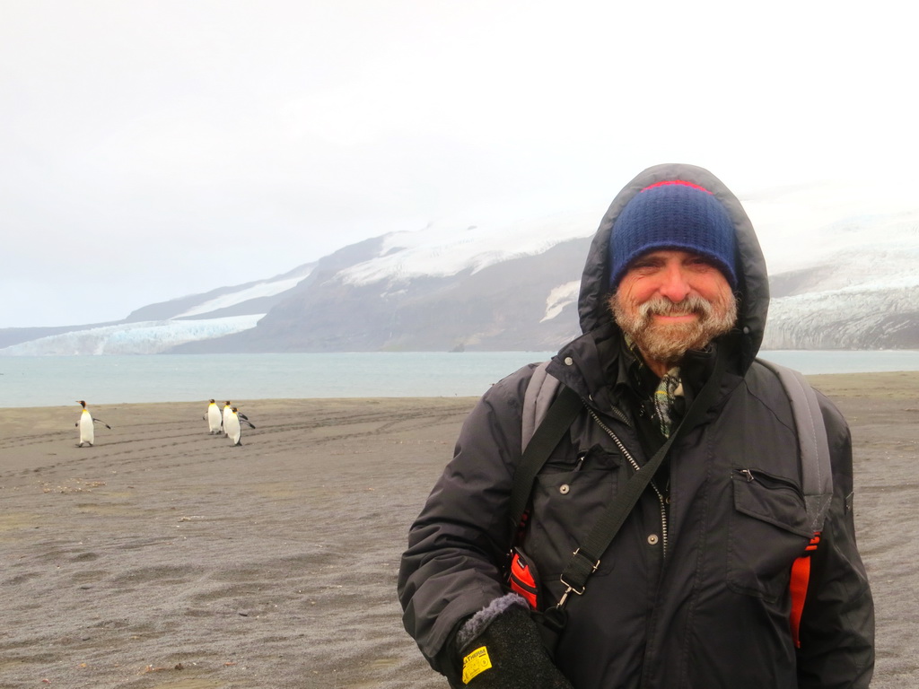
|
| Expedition Organizer and Leader Robert Schmieder KK6EK on Heard Island. Behind him are Corinthian Bay and and the Baudinon Glacier, lying in view from the VKØEK campsite. |
|
May 5, 2016. You probably know most of the news already: We sailed from Cape Town on schedule (March 10), and arrived at Heard Island March 22, after a rather rough, and long, ride on the Braveheart. The next day we began transporting our gear and the team to the island, and setting up our camp. In less than 15 hours, we went on the air and started logging contacts, displaying them in nearly real-time on our special graphic online log DXA.
Over the next 20 days we erected the full set of antennas, and worked into a routine of activities. Most of the team worked the pile-ups, logging around 4000 contact each day with up to six stations. Two team members were there to explore the island, document glacier retreat, collect samples of the rocks, soil, and water, and provide additional manpower for the myriad tasks such as filling generators, repairing equipment, and transporting our supplies from the beach (about 500 m away). The Braveheart crew made extraordinary effort, supplying us with food and transporting the field scientists to remote parts of the island.
Finally, on April 11, a month after we left South Africa, we struck camp and beat a retreat as winter weather began closing in on us. The entire campsite was dismantled and transported to the Braveheart in less than 9 hours, and as is our requirement, we left the campsite completely clean. Altogether we accumulated 75,000 radio contacts, about 50 rock specimens, about 20 soil samples, and about 15 glacial water samples. The team also came back with 450 GB of photographs.
Thanks to our Inmarsat BGAN terminals, we had a reasonably fast connection to the internet, and we were able to carry on extensive communications with family, the support team, and many individual DXers and scientists. Much of our effort was made possible by the extensive and innovative support teams: The Diablo Dxers organized and led by so-Organizer Rich Holoch KY6R, by souvenir manager Manny Rodriguez K4MSR, and by support teams in Cape Town (Paul ZS1S) and Perth (Keith VK6RK). In particular, the extensive outreach via social media, implemented by the Diablo DXers, clearly was a major advance, and (we hope!) represents a new standard for future DXpeditions.
Although there was the usual interference and criticism of the VKØEK operation, and we were not able to obtain the number of QSOs and hydro-bio-geological specimens we had hoped due to the extremely challenging weather and disappointedly poor radio propagation, we are quite happy with the operation, and hope you agree it was worth the effort and the support. For all of you who did support us financially and in other ways, thanks you so much. All of us, and all of you, can say:
"I helped make it happen!"
We'll soon be presenting more details of the Heard Island Expedition, and we invite your continued interest and interactions.
Bob KK6EK |
EXPEDITION IS UNDERWAY!
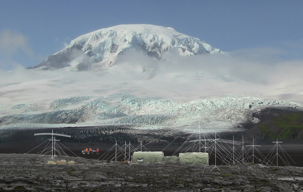 |
| The campsite on Heard Island [click to enlarge] |
|
April 1, 2016. The 2016 Cordell Expedition to Heard Island is in full operation.
The main operations site of the 2016 Cordell Expedition to Heard Island lies at the foot of the 9000-ft. peak of Big Ben. The dark area between the volcano and the campsite is a featureless plain of volcanic cinders. The array of antennas around the site provides the capability to make amateur radio contacts on all major bands and modes, using the callsign VKØEK. Just inside the window of the op tent (left) are the satellite terminals that provide full connection to the internet, enabling real-time upload of the radio log and its display on the web page DXA, as well as effectively unlimited communications via social media. In the distance another load of cargo is being transported to the site using the 4-wheel drive vehicle. Near the peak of Big Ben an elevated vent is emitting dark fumes, which follows the full-scale eruption two months earlier.
A special issue of the Newsletter provides some images and details about the operation as it was underway. This Newsletter was issued after the operation was completed (it was not possible to edit and distribute it from Heard Island). You can download the Newsletter by clicking on the image below.
|

|
| Newsletter Issue 02_04 is dated April 1, 2016. [Click image above to download Newsletter PDF (2.1 MB)] |
A PERSONAL MESSAGE FROM THE EXPEDITION LEADER
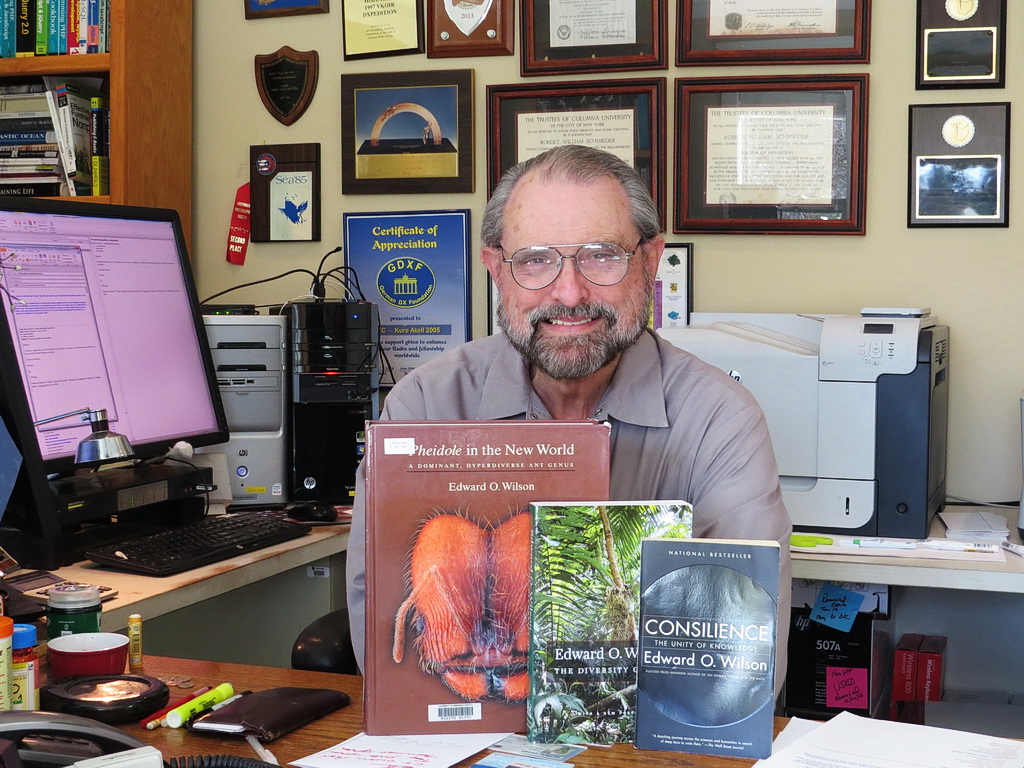
|
| Expedition Organizer and Leader Robert Schmieder packing for the expedition. In front of him are three books by the Honorary Principal Scientist Harvard Biologist Edward O. Wilson; Bob will take two of them (The Diversity of Life and Consilience) with him. |
|
March 1, 2016. No matter how much you prepare for an adventure like this, it's always a rush when it is about to actually happen. Now, after 3 years of planning and preparation, it is. If I may, I'll use the same words I used when we were about to land on Heard Island in 1997: "We're ready!"
If you have looked at our Project Poster, you'll see how many people have been involved in making this happen--a "small staff" of about a dozen, about a hundred implementing and tending various equipage and logistical activities, and perhaps a thousand others indirectly involved in fulfilment of individual items. Of course, the list is only a fraction of the rest of "the team": the DXers who will make a contact with the camp on Heard Island, logging a contact with VKØEK. After almost 20 years, this will be a relief for some, a thrill for others, and probably a source of debate about the project for years.
For those of us who will sail out of Cape Town on March 10, it is an E-ticket ride. Some of you know the ups and downs we have experienced over the course of creating the project, and now that seems less like trouble and more like a thrilling roller coaster ride. For those of you who have supported us with your contributions, we have a special feeling: you made this expedition financially successful so we could spend our time preparing rather than fundraising. For those of you who have sent good wishes, we carry them with us, with warm thanks. For those of you who will keep our home fires burning for two months, you will constantly be in our thoughts.
And now, a special message for the DXers: For those of you who will be working hard to make a contact with VKØEK, please keep in mind that both you and we are on the same team--we both want to get you in the log. We will be working hard for you, and we would like you to help us by maintaining a high level of those virtues that will make this operation fun and rewarding: patience, charity, and mutual support. We want you to have a great time watching and interacting with the DXpedition, and we'll celebrate the success of the operation if everyone can truthfully embrace our motto:
"I helped make it happen!"
Thanks all, and we'll look for you from Heard Island.
Bob KK6EK |
EXPEDITION TEAM HEADS FOR CAPE TOWN
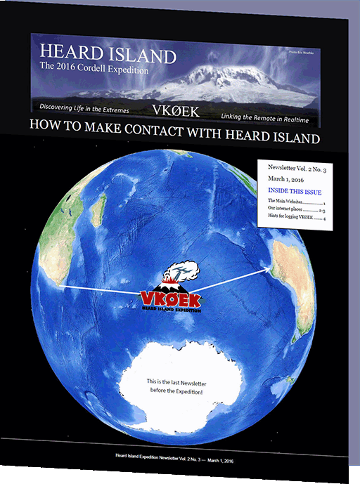
|
| Newsletter Issue 02_03 goes out today. It's for helping you make contect with the Expedition and log a QSO with VKØEK |
|
March 1, 2016. Today the first of the Heard Island Expedition Team board flights for Cape Town, South Africa, the accumulation point for the expedition to Heard Island.
The first three to depart, Bob Schmieder KK6EK, Ken Karr NG2H, and Adam Brown K2ARB, will arrive in Cape Town at 1:00 PM local time, to be met by members of the South Africa Support Team. They will be followed over the next four days by the other team members: Fred Belton KM4MXD, Arliss Thompson W7XU, Gavin Marshall VK2BAX, Hans-Peter Blattler HB9BXE, Alan Cheshire VK6CQ, Bill Mitchell AEØEE, Dave Lloyd K3EL, Jim Colletto N6TQ, Vadym Ivliev UT6UD, Dave Farnsworth WJ2O, and Carlos Nascimento NP4IW.
The Cape Town Support Team has been interfacing with the vessel (also due to arrive in Cape Town March 3), and the local agency for inspecting the vessel and cargo for biological threats. We will be shopping, cleaning the tents, and loading the Braveheart, preparing for the scheduled sailing on March 10. |
|
FINAL PERMIT FOR THE EXPEDITION IS RECEIVED
1024.jpg)
|
The expedition is permitted to collect specimens within the red-bounded zone. This is one of three main areas in which the expedition is permitted to collect specimens. The AAD configured this zone according to the requests from Cordell Expedition, taking into account the sensitive nature of the environment, the potential dangers to explorers, and the opportunity to obtain new information about the environment. The area above is at the extreme eastern end of the island. The large (ca 1 mile) lagoon was created recently by the very rapid melting of the lagoon, seen now as jsut a narrow snow ribbon entering the lagoon. The extension to Brown Lagoon and the rectangular extension were added to enable the team to reach areas that have been recently (last 10 years) deglaciated.
NOTE: This figure is rotated approximately 90° counterclockwise--north is to the left. |
|
March 1, 2016. Today we received the Final permit for conducting the 2016 expedition to Heard Island. The permit was forwarded by James Fleming, Policy Legal Officer,
Strategies Branch,
Australian Antarctic Division (AAD). The AAD is the agency that manages the Heard Island and McDonald Islands Marine Reserve.
Over a period of more than two years, Cordell Expeditions has been presenting its plan for a major scientific expedition to Heard Island, the first in almost 20 years. Because of the extreme sensitivity of the island to climate, and therefore climate change, major changes have occured on the island during this interval, providing the core motivation for the project. Furthermore, Heard Island has no identified human-introduced species, and the AAD is diligent in enforcing the legislation that mandates strict controls over who, when, and how the island may be visited. Among other restrictions, research expeditions are required to undergo a rigorous cleaning and inspection of the vessel and facilities to be taken on the island.
While this was a long, and expensive (including two trips to Tasmania) process, we are in agreement with the motivation, the procedure, and the result. The AAD required us to justify the quality and importance of the research we were proposing, and to provide extensive assurances that the field work would be safe to both the personnel and the environment. So while these requirements increased the time and the cost of the project, we are pleased that the island resources, so important as a natural laboratory in which to study climate change, is being protected and maintained.
The full text and illustrations of the permit are available here. The set of proposed research projects that was approved by the AAD is here. |
|
NEWS ARCHIVES 3 (Nov. 2015 - Feb. 2016)
NEWS ARCHIVES 2 (May 2015 - Nov. 2015)
NEWS ARCHIVES 1 (2014 - Apr. 2015)
| | | | | | | | | | | | | | | | | | | | | | |

