
NEWS ARCHIVES 2
Nov. 2015 - Feb. 2016
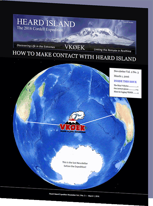
LAST NEWSLETTER BEFORE THE EXPEDITION IS "HELP" ISSUE
| ||
| Newsletter Issue 02_03 goes out today. It's for helping you make contect with the Expedition and log a QSO with VKØEK |
Feb. 29, 2016. The last Newsletter before the expedition is being mailed today. It will go out to about 2000 subscribers; you can obtain it by clicking on the image above. This Newsletter is filled with hints and links to help you make contact with the Heard Island Expedition, and to get a confirmed contact in the VKØEK log. Inside you'll find links to the various websites for the expedition, and many other places that will help you follow along as the voyage progresses. For DXers, perhaps the most important page is DXA, which enables you to get online confirmation of your QSO within 1 minute of making it. The other important page is Contact us. If you have a question, problem or comment anytime, you are welcome to use this link to open a "ticket," which will be processed by our "Customer Service Team." This system replaces ther traditional "Pilot" system, which we found to be inadequate for the off-line communications needs of an expedition as complicated as this one. |
|
2016 EXPEDITION HANDBOOK RUNS TO 450 PAGES
MEETING LINKS EXPEDITION WITH OPERATIONS NEARLY 50 YEARS AGO
| ||||
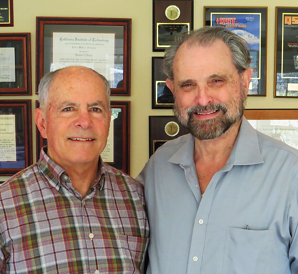
| Hugh Milburn, who was active on Heard Island in 1969 as VKØHM, paid a visit to Expedition Leader Bob Schmieder. Hugh is one of a handfull of people who have had the extraordinary experience of visiting and working on Heard Island. He was there nearly 50 years ago. Bob's previous visit was a mere 20 years ago. | ||||
| ||||
| The ANARE site is reclaimed by the elements. (Upper row) 1947, 1969. (Lower row) 1997, 2012. | ||||
|
||||
EXPEDITION ACTIVATES THE AUDIOLOG
| ||
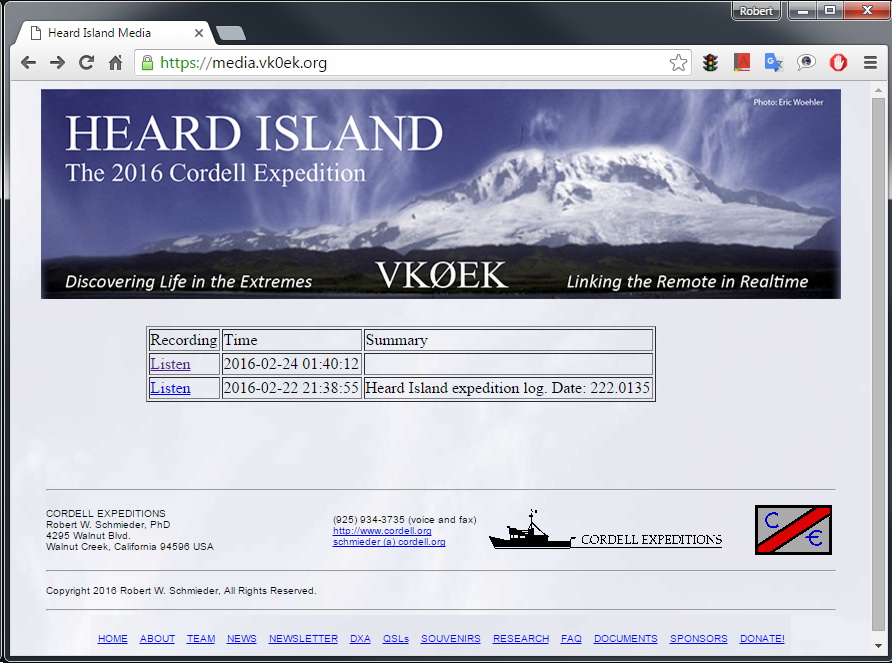
| The Heard Island Expedition Audio Log captures verbal reports for the expedition, and enable you to play them on a webbrowser | ||
| ||
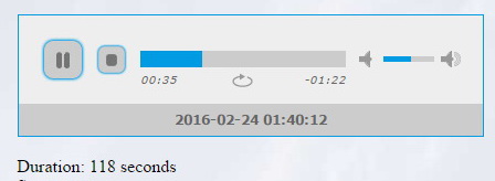
| When you select a log entry, the player plays it! | ||
Feb. 22, 2016. We are excited to announce the implementation of the Heard Island AudioLog. This service enables us to call on a telephone from the any location (including from Heard Island!), and make an audio recording. The system automatically captures the audio track, and provides it online for anyone to listen with any browser. You can listen to the initial recording made in the past two days by going to https://media.vk0ek.org. When you chose a log entry ("Listen"), the player will start. The date-time that the track was recorded is shown on the player, and the duration of the track is shown below. You can player it again if you wish, or go to a different track. The AudioLog was implemented by our local support team member Mike Coffey KJ4Z, who also is responsible for completing the souvenir store. |
||
THE SOUVENIR STORE IS OPEN!
 |
| The Heard Island Expedition VKØEK store is open for business! [Click on image to visit the store.] | ||
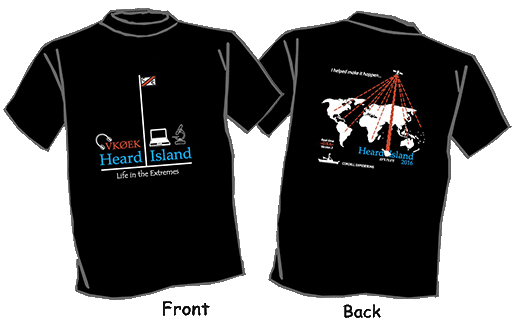
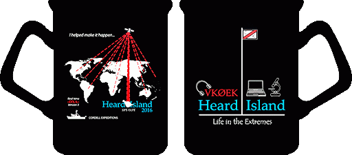
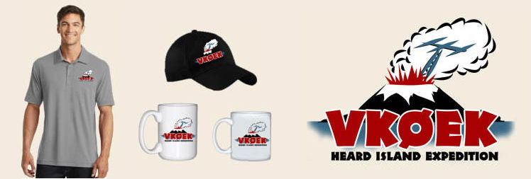
Feb. 21, 2016. We are very pleased to announce that the store for ordering Heard Island VKØEK souvenirs is open for business. We offer two designs of the traditional mug and shirt souvenirs: 1. The classic Cordell Expeditions design: a three-color layout on black that represents the essentials of the expedition: the location, the three main activities (radio, science, and communications), and the classic motto "I helped make it happen." The motto reflects the fact that thousands of individuals contributed in large and small ways to enable the project. These souvenirs will be distributed by the East Coast Support Team. 2. The exciting VKØEK DXpedition design, featuring an erupting volcano. Ironically, the design proved to be prescient, because Big Ben, the 9000-ft. volcano on Heard Island actually erupted on Feb. 1, 2016! These souvenirs will be distributed by Astrids. You can get these souvenirs by clicking on the link /SOUVENIRS/on the main menus and on the images above. |
||
FOLLOW THE 2016 HEARD ISLAND EXPEDITION ON WSPR!
 |
||
| Test of the VKØEK WSPR beacon net, carried out by Adam K2ARB | ||
[Prepared by team member Adam Brown K2ARB] Feb. 20, 2016. Would you like to follow via amateur radio the VKØEK expedition from Cape Town to Heard Island to Perth? It will now be possible via WSPRnet.org, the Weak Signal Propagation Reporter Network! WSPRnet is compromised of a constellation of lower power HF stations around the globe transmitting and receiving digital signals using the WPSR protocol originally developed by Joe Taylor K1JT and sustained by a community of WSPR enthusiasts. Many of these stations around the world send automated WSPR reception reports over the Internet to the WSPRnet.org web site where they are recorded in a searchable database and on a world map. The VKØEK 2016 Heard Island Expedition will carry operate a 250-milliwatt battery-powered propagation beacon kit developed by www.qrp-labs.com and assembled by expedition supporter Richard AB4ZT. The beacon is capable of transmitting on 40-30-20-17-15-10 meters. During the first day of testing by expedition member Adam K2ARB (using a dipole in NJ), signal reports were received by amateurs from as far California and Italy! The beacon will be deployed in Cape Town as ZS/K2ARB, on the R/V Braveheart during the voyage as ZL/K2ARB/MM, and on Heard Island as VKØEK. We will be cycling the beacon through the bands during the expedition. Given that we will be thousands of miles from the nearest amateur stations, it will hard to miss us on the map! If you would like to follow along on the expedition, and gain insights into the state of propagation to the southern Indian Ocean, (1) visit http://www.wsprnet.org; (2) click “Map” in the upper right hand corner; 3) set the search parameters for “all” bands and “24 hours”, and (4) look for our callsigns, or search for them in the permanent database of real-time WSPR reception reports. But do not rely on WSPR alone! WSPR is only one of many propagation tools available to hams chasing VKØEK and we recommend that you take advantage of all of them. Do not be dismayed if you do not see us indicated on the WSPR map on a particular day. It may simply be that we have chosen to transmit WSPR signals on a closed band in search of a possible opening. So while we may not appear on the WSPR web site on a particular day, we will be banging out thousands of QSO’s on the other bands! WSPR is a fun and interesting corner of the amateur world. Feel free to follow along! |
HOW'S DX? QST NOTES VKØEK IS JUST A MONTH AWAY
 |
||
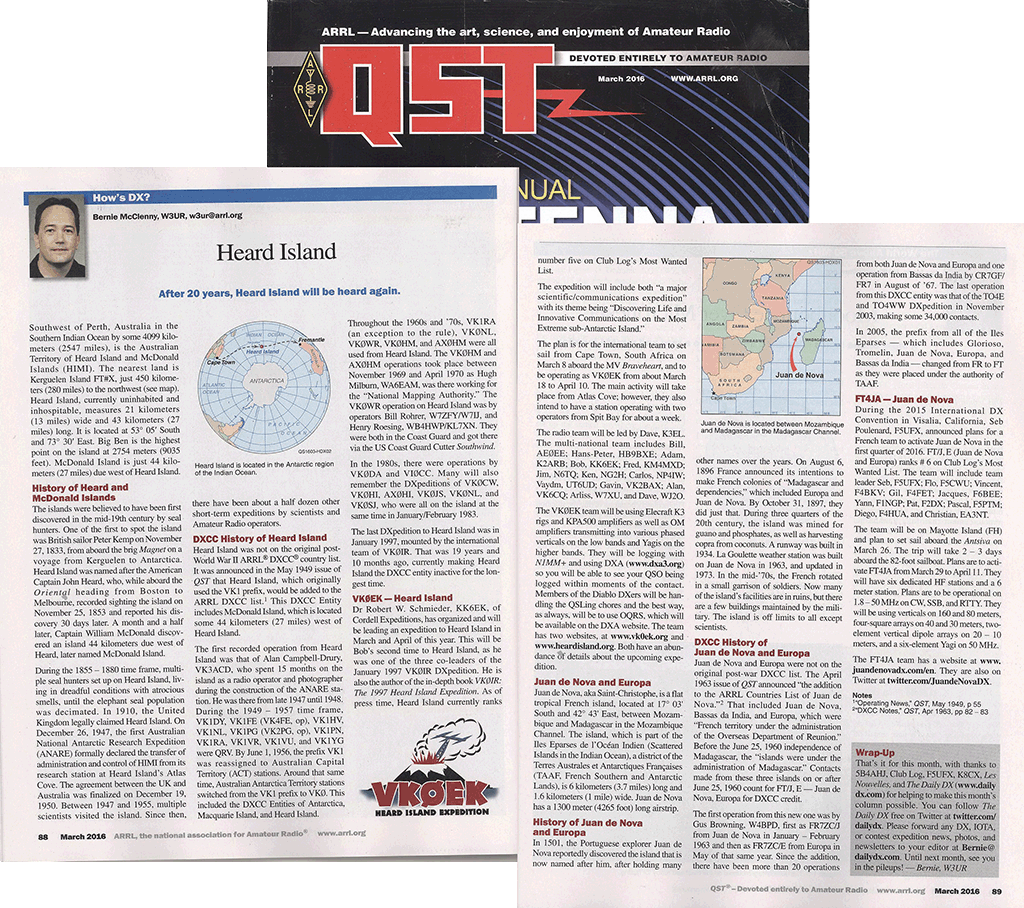
| The March 2016 issue of QST includes a nice account of the radio history of Heard Island, as well as the alert that the island will become active again in March, after 19 years of silence [Reprinted with the permission of the ARRL. Copyright © American Radio Relay League] | ||
Feb. 19, 2016. Carrying on a multi-decade tradition, Bernie McClenny W3UR, presents the Hows DX? column in QST each month. In the current (June, 2016) issue, Bernie reviews the political and radio history of Heard Island, including the discovery of the island in 1833 and the first amateur radio operation in 1947. A fascinating fact about those early years is that there are numerous descendants (even children) of those early explorers alive today. Bernie then advises what most DXers probably already know: that after 19 year of silence, Heard Island will once again be on the air, this time as VKØEK. Of course that is what this project is about, and most readers of this column are already familiar with the project (3 years in the making!). For us, Bernie's column marks a milestone: a month from landing on the island and setting up the operation. As you might imagine, these are busy times for the team and supporters. Although the major gear is already in a warehouse in Cape Town awaiting our arrival, now there are so many details, so little time. Just in case you missed the last Newsletter, which featured a chart of the extended team necessary to make this happen, you can download it by clicking on the image above. |
THE OFFICIAL 2016 HEARD ISLAND EXPEDITION LOGOS
|
 |
|
| The 2016 Heard Island Expedition logo. This logo is available on mug and tee-shirt souvenirs. Click to enlarge. | ||
Feb. 18, 2016. We are pleased to present the official 2016 Heard Island Expedition logo. The two images above are (left) obverse and (right) reverse of the logo. They will be used on our souvenir mugs and tee-shirts (see /SOUVENIRS/). You are welcome to download these logos and use them wherever you wish. Click on the images above for an enlargement. Click here to obtain the original Adobe CS6 Illustrator file (931 kB). We suggest that if you are a sponsor of the expedition (i.e., your name appears on the SPONSORS page), you might wish to grab this logo and display it on your own web page to show off your sponsorship, the same way clubs and foundations do. You might even attach a link to the logo pointing to either the EXpedition or the DXpedition.
|
JA DXERS PROVIDING MAJOR SUPPORT FOR VKØEK
 |
| Hams hamming it up at the 2013 ham fair in Tokyo. (Left) Expedition Leader Robert Schmieder KK6EK with Kan JA1BK. (Middle) A group of attendees at the banquet: JP7FSO, JA7HMZ, JA8CDT, JA1WSX, JR7CJS, and JH6RTO. (Right) Zorro JH1AJT hams it up with Kay, XYL of KK6EK. |
Feb. 18, 2016. It is with great pleasure that we acknowledge the very generous support being received from DXers in Japan. Almost every day there are donations from JA hams, some large and some small. Together these are providing a significant amount of support, helping ensure that the VKØEK team can continue to concentrate on the preparations and be free from the distraction of active fundraising. Two of the most prominent Japanese DXers, Kan Mizoguchi JA1BK and Yasuo Miyazawa (Zorro) JH1AJT have made major donations in the Elephant Seal category (more than $1000). In fact, both of these donations were more than twice that threshold amount.In addition, another JA ham made a donation in this category, but wishes to remain anonymous. We suspect that these famous hams have a stimulating effect on the JA DXing community, encouraging contributions via our PayPal link. Very often we see a cluster of donations which we think was stimulated by a meeting, a presentation, or perhaps an interview. We send our deep appreciation to the three hams mentioned here, but also to the many JA operators who are adding to the certainty that this extordinarily expensive DXpedition will be a success. We like them to say: I helped make it happen! |
PROF. EDWARD O. WILSON IS HONORARY PRINCIPAL SCIENTIST
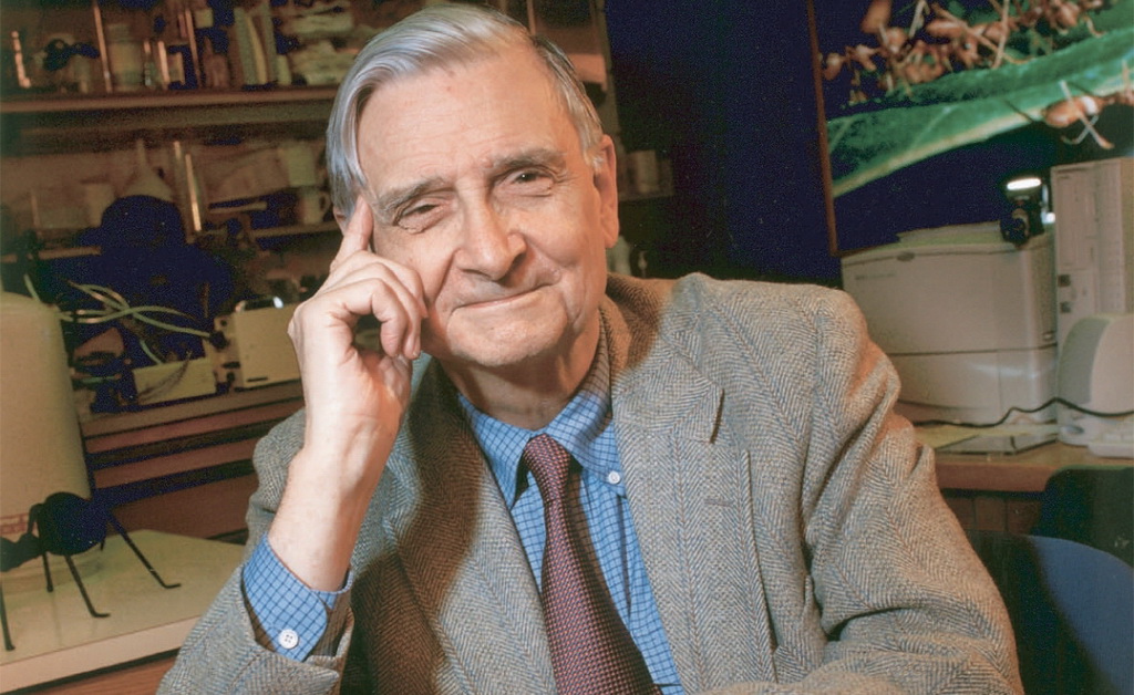 |
| Harvard Prof. Emeritus E. O. Wilson, legendary biologist and world authority on biodiversity. |
Feb. 17, 2016. We are delighted to announce that Prof. E. O. Wilson of Harvard University will hold the title of Honorary Principal Scientist for the 2016 Cordell Expedition to Heard Island. [From Wikipedia] Wilson is known for his scientific career, his role as "the father of sociobiology" and "the father of biodiversity", his environmental advocacy, and his secular-humanist and deist ideas pertaining to religious and ethical matters. Among his greatest contributions to ecological theory is the theory of island biogeography, which he developed in collaboration with the mathematical ecologist Robert MacArthur, and which is seen as the foundation of the development of conservation area design, as well as the unified neutral theory of biodiversity of Stephen Hubbell. Wilson is the Pellegrino University Research Professor, Emeritus in Entomology for the Department of Organismic and Evolutionary Biology at Harvard University, a lecturer at Duke University, and a Fellow of the Committee for Skeptical Inquiry. He is a Humanist Laureate of the International Academy of Humanism. He is a two-time winner of the Pulitzer Prize for General Non-Fiction (for On Human Nature in 1979, and The Ants in 1991) and a New York Times bestseller for The Social Conquest of Earth, Letters to a Young Scientist, and The Meaning of Human Existence. E. O, as he is univerally known, has been the recipient of many awards, including the Newcomb Cleveland Prize (1967), Leidy Award (1979), Pulitzer Prize (1979), Tyler Prize for Environmental Achievement (1984), Crafoord Prize (1990), Pulitzer Prize (1991), International Prize for Biology (1993), Carl Sagan Award for Public Understanding of Science (1994), Kistler Prize (2000), Nierenberg Prize (2001), BBVA Foundation Frontiers of Knowledge Award in Ecology and Conservation Biology (2010), and the International Cosmos Prize (2012). He published 13 books in the new millennium: The Future of Life, 2002, Pheidole in the New World: A Dominant, Hyperdiverse Ant Genus, 2003, From So Simple a Beginning: Darwin's Four Great Books, 2005, The Creation: An Appeal to Save Life on Earth,September 2006, Nature Revealed: Selected Writings 1949–2006, The Superorganism: The Beauty, Elegance, and Strangeness of Insect Societies, 2009, Anthill: A Novel April 2010, Kingdom of Ants: Jose Celestino Mutis and the Dawn of Natural History in the New World, 2010, The Leafcutter Ants: Civilization by Instinct, 2011, The Social Conquest of Earth, 2012. He published 3 books in 2014 alone: Letters to a Young Scientist, A Window on Eternity: A Biologist's Walk Through Gorongosa National Park, and The Meaning of Human Existence. Wilson has been part of the international conservation movement, as a consultant to Columbia University's Earth Institute, as a director of the American Museum of Natural History, Conservation International, The Nature Conservancy and the World Wildlife Fund. A full CV for E. O. Wilson is available here. The relatioinship between Prof. Wilson and Expedition Leader Robert Schmieder goes back more than 40 years. It was the MacArthur-Wilson Theory of Island Biogeography that motivated Schmieder into a career of exploring remote islands, and led to his coining the term "underwater island." Wilson provided a complimentary review of Schmieder's 1991 book Ecology of an Underwater Island. We are extremely happy to have E. O. "on the Heard Island team." |
QSL PROCEDURE AND POLICY ANNOUNCED
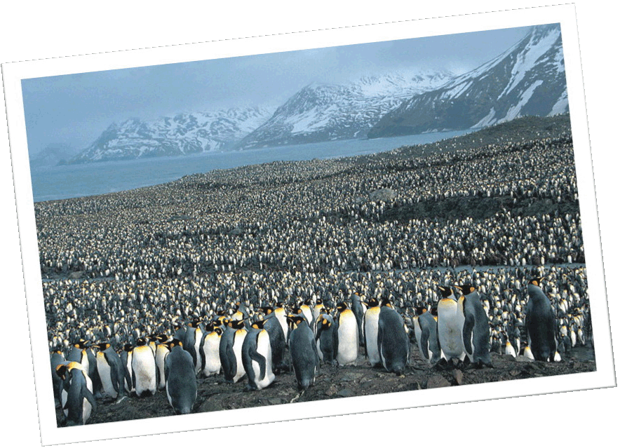 |
| Believe it or not, this is the Heard Island DX Club, waiting to work you at your QTH. You're DX for them! [Not the VKØEK QSL card, of course] |
Feb. 16, 2016. We announce our procedure and policy for QSL confirmation of logged contacts with VKØEK. A central feature of the QSL service is the ability to order from a web page that displays graphically your logged contacts (the "greenies" table). The QSL service will cost US $5, and will be FAST. The Procedure and Policy is accessible from the link QSLs on the main website www.heardisland.org, which is also implemented on the VKØEK blog www.vk0ek.org and the DXA page http://www.dxa3.org. |
EXPEDITION PARTNERS WITH THREE SCHOOLS (SO FAR!)
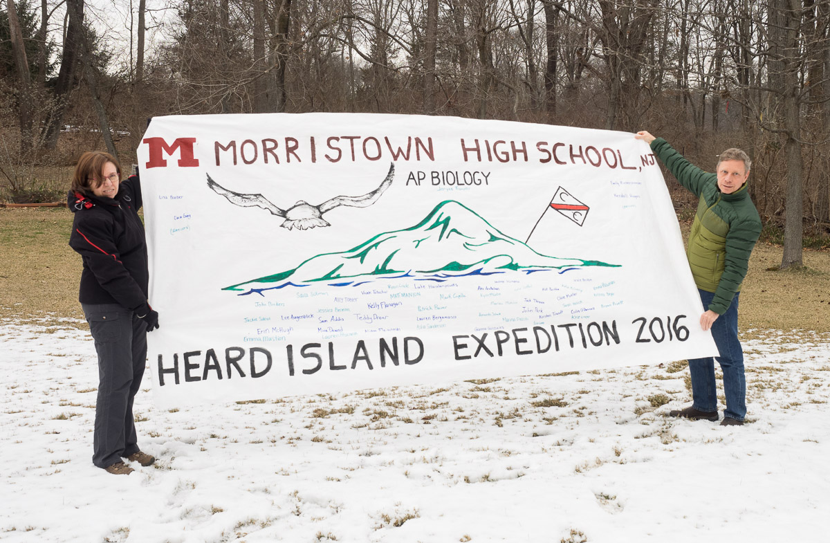 |
| (Above) Radio team leader Dave K3EL and his wife display the banner delivered by Morristown High School (NJ) teacher Janyce Trampler. (Below) The banner provided to us by Beverley Matheson WA6BK, teacher at the Dorothy Grant Elementary School in Fontana, California. |
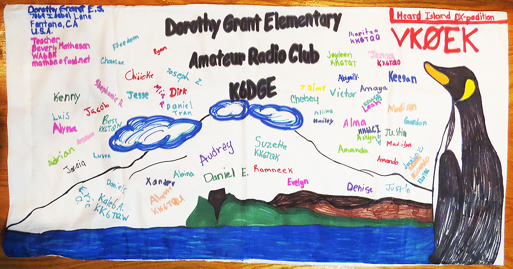 |
Feb. 7, 2016. We are excited to report that two schools with active science programs have provided banners to carry on the expedition. We will not only carry their banners and photograph them during our stay on the island, but we will also interact with the teachers and students to provide information and encouragement to the students. James Knight, W2JLK, introduced us to Morristown High School (Morristown, NJ) biology teacher and Rutgers University adjunct professor Ms. Janyce Trampler, and we have teamed up to give Morristown HS students a unique educational experience. Senior students in Ms. Trampler's two Advanced Placement biology classes (a total of 48 students) will get a chance glimpse an expedition to a rare and exotic location – Heard Island – in action and will have the unique opportunity, via satellite links, to meet and talk with biology and geology researchers on the island and to watch research activities in progress in near-real time. The expedition’s real-time website (http://www.dxa3.org) will show students real-time contacts between the ham team and amateurs throughout the world. Satellite links will allow students to view biological specimens, see the field data collection work, talk with biologist researchers and ask questions and even suggest names for new species that might be discovered in Heard Island’s unique volcanic biologic environment. We are sure that this opportunity to see both real world biology science and ham radio in action will inspire students and produce new scientists, engineers and radio amateurs. The school website is here.
These educational connections are important to us: Literally, an "expedition" is a journey undertaken for a purpose. One of our main purposes is to communicate with people worldwide, using the latest in technology to enable real-time communications, and to return with information that will be of value to scientists, both present and future. We believe that these highly motivated students have an opportunity to be innovators, especially in the fields of environmental and Earth science, volcanology, biology, meteorology, marine science, and communications. We hope that the Heard Island experience will give these students an event that will enhance their lives, and we look forward to this partnership. We salute the teachers for their effort and innovative spirit. |
EQUIPMENT ARRIVES IN CAPE TOWN
|
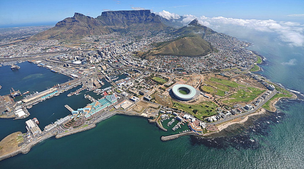
| Drone view of Cape Town, South Africa. The port facility where we will load the vessel and depart for Heard Island is at left. |
Feb. 5, 2016. The container carrying the equipment for the expedition has arrived in Cape Town, South Africa, and has been put into storage awaiting arrival of the advance team March. 3. The vessel Braveheart will arrive March 5, while the full team will arrive March 7. We will sail for Heard Island March 10, weather permitting, of course! The local arrangements are being managed by Meihuizen International. In addition, we are very appreciative of our South Africa team: Paul ZS1S, Pierre ZS1HF, Malcolm ZS6MAL, Dennis ZS1AU, Sue ZS1AFR, and Tom ZS1AFS. Together with similar teams in California, Virginia, and Perth, Australia, the logistics is being managed professionally and securely. |
HEARD ISLAND VOLCANO IS ERUPTING!

|
| (Above) Big Ben, atop Heard Island, erupts with a plume of smoke. (Below left) Telephoto image shows the buildup of snow and ice around the plume. (Below right) Jodi Fox, geology graduate student at the University of Tasmania, and a collaborator on the 2016 Cordell Expedition. [Source of all images: CSIRO] |
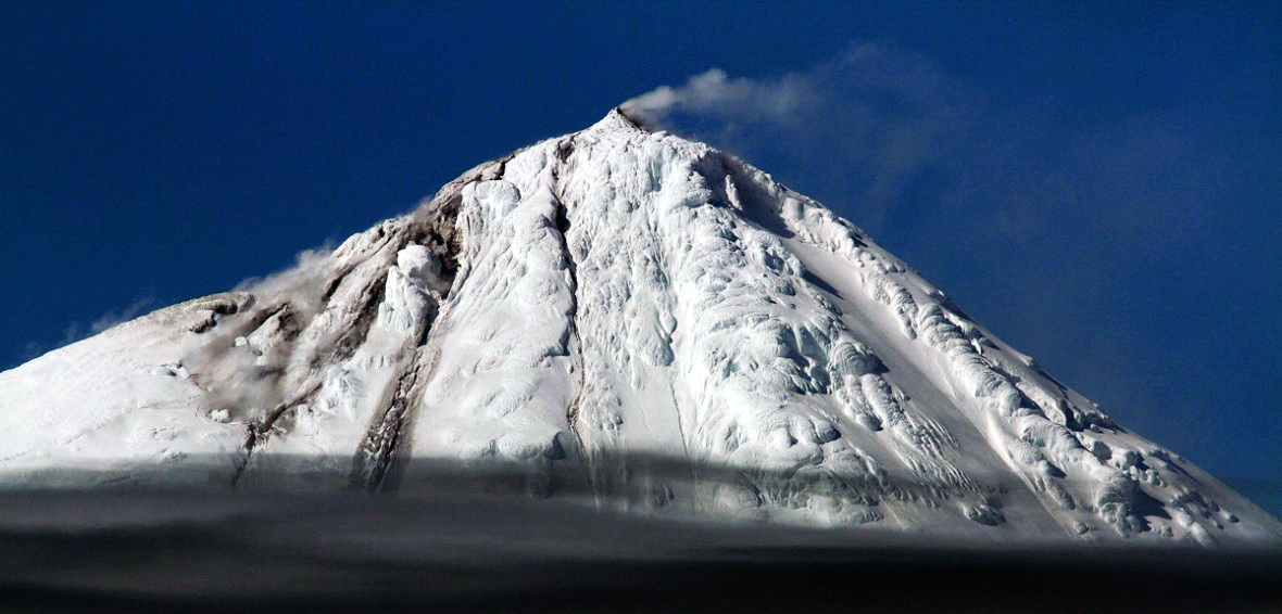 |
| Image above reproduced from International Business Times http://www.ibtimes.co.uk/australias-only-active-volcano-cluster-erupts-big-ben-spewing-lava-down-mountainside-1541190 |
Jan. 31, 2016. We have just received the exciting news that Big Ben, the volcano on Heard Island, is erupting! This rare and exotic event was observed by the CSIRO research team aboard the R/V Investigator. Aboard is Jodi Fox (below right), graduate A video of the event can be found here, and a news note from the University of Tasmania can be found here. There is also an ABC news note here. This event has the potential to alter our scientific program. While the new lava cascading down the southern slope of the mountain is probably too high to reach without technical climbing (which we are not prepared to undertake), meltwater streams emerging from the active area could contain signatures of the new lava. Collection of stream water samples is one of our highest priority objectives. In addition, with our drones, we may be able to get close-up images of the new lava and the effects it is having on the glaciers near the summit. Additionally, we are hopeful that the new activity could trigger new satellite imagery, which will not only show this eruption but all the other changes that have occurred since 2014. For instance, some of the glaciers on Heard Island have been retreating at up to 100 meters per year, creating major lagoons and lakes in their absence. These processes are also central to our research program. Some of the projects we plan to carry out are listed on the /PROJECTS/ page. |
EXPEDITION AWARDED EXPLORERS CLUB FLAG
|
| Expedition Leader Robert Schmieder (right) and team member Louis-Philippe Loncke display the flag of the Explorers Club on Clipperton Island during the 2013 Cordell Expedition to that remote French atoll. A similar photograph will be taken with the flag on Heard Island. |
Jan. 31, 2016. It is with considerable pride that we announce that the 2016 Heard Island Expedition has received a high honor from the Explorers Club: the award of a flag, to be taken on the expedition to Heard Island and returned, together with an official report of the accomplishments of the expedition. In its letter to Expedition Leader Dr. Robert Schmieder, the Club said: The Flag represents an impressive history of courage and accomplishment. It has been carried by our members to the Moon, to the depths of the ocean, and around the globe. It is both an honor and a privilege to receive this special recognition, which we are delighted to extend to you once again. Congratulations! In his acceptance response, Schmieder writes: In a sense, this Expedition has been in the planning for almost two decades, since my previous visit to this extraordinary island in 1997. Active work and preparation has taken three years, due to the several factors of obtaining transportation, financing, a qualified and experienced team, and permits from numerous agencies, particularly the Australian government. The status of Heard Island as a World Heritage site increases our responsibility to plan and implement a project that is not only safe for the participants, but also safe for the site itself, and we believe we have been successful in both these aspects. Schmieder has been a member of the Explorers Club since 1986, and is formally designated a Fellow Emeritus. He has carried the flag on numerous previous expeditions. About the Explorers Club The Explorers Club is an international multidisciplinary professional society dedicated to the advancement of field research and the ideal that it is vital to preserve the instinct to explore. Since its inception in 1904, the Club has served as a meeting point and unifying force for explorers and scientists worldwide. Our headquarters is located at 46 East 70th Street in New York City. Founded in New York City in 1904, The Explorers Club promotes the scientific exploration of land, sea, air, and space by supporting research and education in the physical, natural and biological sciences. The Club’s members have been responsible for an illustrious series of famous firsts: First to the North Pole, first to the South Pole, first to the summit of Mount Everest, first to the deepest point in the ocean, first to the surface of the moon—all accomplished by our members. The Club provides expedition resources including funding, online information, and member-to-member consultation. And our famed annual dinners honor accomplishments in exploration. But probably the most powerful resource available to those who join the Club is fellowship with other members—a global network of expertise, experience, technology, industry, and support. The Explorers Club actively encourages public interest in exploration and the sciences through its public lectures program, publications, travel program, and other events. The Club also maintains Research Collections, including a library and map room, to preserve the history of the Club and to assist those interested and engaged in exploration and scientific research. For more information about the Explorers Club, click here. |
PETE W6OP COMPLETES DXA3 UPGRADE
|
Jan. 23, 2016. Pete Bourget W6OP as completed the upgrade of DXA to its current version DXA3. Among several new features, Pete implemented access to Google Maps. The DXA1 and DXA2 versions used an equidistant azimuthal map that shows the entire world, with the DX location at the center and DXers logged within the last minute appear as flags located on their QTHs. Now, you can click on the "Select Map" link (at left) and switch to the Google Mercator projection. This will enable you to zoom to any area on the Earth, so you could watch the activity of a particular area, or even watch one particular DXer if you wish. In addition, you will be able to click links at left to order your QSLs, souvenirs, and make a voluntary donation, as well as get HELP on DXA. We hope you will watch DXA during the VKØEK opperation, and we hope you enjoy it! To see the live simulation of DXA, click on any of the images above, or go to http://www.dxa3.org. |
EXPEDITION TO HELP FILL GAP IN TWO MAJOR
INTERNATIONAL CLIMATE RESEARCH PROGRAMS
Jan. 21, 2016. As they track their way across the stormy southern Indian Ocean from Cape Town to Perth, the 2016 Heard Island Expedition participants and the crew of the M/V Braveheart will launch a string of oceanographic buoys in support of climate research by three of the world’s leading scientific organizations: the Woods Hole Oceanographic Institute (WHOI), the National Oceanographic and Atmospheric Administration (NOAA), and the Scripps Institute of Oceanography.
“Our expedition is committed to supporting science of the greatest importance, and climate change research is at the top of our list of priorities. We feel that assisting the oceanographic research of these institutions complements the land-based scientific work that we will undertake on Heard Island itself,” reports Dr. Robert Schmieder, organizer of the expedition. The buoys are components of a coordinated worldwide deployment of several thousand buoys that scientific organizations have launched to measure the currents, sea temperatures and other environmental factors that are essential to understanding how the oceans fit into the earth’s deeply complex weather system. “After years of study, the full role of the Southern Ocean in worldwide climate change remains unknown, and the ability of the Heard Island Expedition and the Braveheart to launch buoys for us in this rarely visited part of the world is of great assistance,” stated Dr. Pelle Robbins, Research Specialist in the Physical Oceanography Department at the Woods Hole Oceanographic Institute. The WHOI Argo Program WHOI, as well as Scripps, are active participants in the worldwide consortium of scientific organizations that maintains the Argo Program, a constellation of nearly 4,000 diving buoys worldwide. The six-foot long cylindrical SOLO (Sounding Oceanographic Lagrangian Observer) buoys measure and transmit the basic physical state of the upper ocean by descending to depths of 6,000 feet by means of preprogrammed mechanical changes in buoyancy (see image above). Electronic sensors at the top end of each buoy record profiles of temperature, salinity and depth. As each buoy periodically resurfaces, it “phones home” by satellite and downloads its recorded data. The life expectancy of a SOLO buoy is 4 – 5 years and its mission can be reprogrammed remotely via satellite.
The NOAA Global Drifter Program In addition to the ARGO buoys, the Heard Island Expedition will launch a group of “global drifting buoys” in behalf of NOAA and possibly the South African Weather Service. The 1,250 satellite tracked “drifters” worldwide remain on the surface during their approximately four-year lifespan, continuously reporting on their location as well as currents, sea surface temperature, atmospheric pressure, winds and salinity.
Follow Along! The Argo and drifting buoys will be launched by the Heard Island Expedition in the areas of greatest need, marked in red in the image below. “Because the location of the existing buoys is changing constantly, we will work during the voyage with the sponsoring scientific organizations to find the optimal site for each buoy that we deploy,” reports Adam Brown K2ARB, an Expedition participant and Antarctic veteran who was tasked with coordinating buoy deployment with the various scientific organizations and agencies.
As the Expedition launches each ARGO and global drifting buoy, the buoy’s unique serial number will be recorded and transmitted to the international organizations managing the buoy constellations. Once recorded, data from the buoys will be freely available on the Internet to scientists and the general public. The Expedition will publish on its website the serial numbers of its buoys. To follow our buoys: ARGO buoys: http://floats.pmel.noaa.gov/dataselect/select.php?area=INDIAN For more details, contact the Expedition Leader or visit: The 2016 Heard Island Expedition: http://www.heardisland.org Argo Float Design The Heard Island Project is a multidisciplinary scientific expedition to Heard Island, Territory of Australia, in the Southern Ocean, during March/April, 2016. The major goals of the expedition are: (1) to discover and document species in order to extend the known biodiversity of this extremely isolated, extremely severe ecosystem; (2) to develop, deploy, and operate an innovative communications system to enable radio amateurs worldwide to make a confirmed contact with Heard Island, and to provide real-time links to the internet for safety, scientific collaboration, and public information; and (3) to utilize the wide variety of social media accessible through the internet to link very remote sites such as Heard Island with interested persons in real time. The website for this project is www.heardisland.org, and the blogsite is www.vk0ek.org. There is also presence on Facebook and Twitter, Cordell Expeditions is a private nonprofit scientific research organization located in Walnut Creek, California. Cordell Expeditions has a 35-year record of successful scientific expeditions to remote oceanic sites, with Dr. Robert Schmieder as Director, Organizer, and Expedition Leader. Details about the organization are available at www.cordell.org. M/V Braveheart is an ocean-going expedition and research vessel an owned and operated by Nigel Jolly of Stoney Creek Shipping Co. Ltd, Palmerston North, New Zealand. http://www.braveheart.pn/ The Woods Hole Oceanographic Institution (WHOI) is a private, nonprofit research and higher education facility dedicated to the study of all aspects of marine science and engineering and to the education of marine researchers. Established in 1930, it is the largest independent oceanographic research institution in the U.S., with staff and students numbering about 1,000. The Institution is organized into six departments: Four ocean institutes—ocean life, coastal ocean, ocean and climate change, deep ocean exploration and two additional organizations: the Cooperative Institute for Climate and Ocean Research, and a Marine Policy Center. Its shore-based facilities are located in the village of Woods Hole, Massachusetts, United States and a mile and a half away on the Quissett Campus. The National Oceanic and Atmospheric Administration (NOAA) is an American scientific agency within the United States Department of Commerce employing 12,000 civilians and 600 uniformed service offices. NOAA focuses on the conditions of the oceans and the atmosphere. NOAA warns of dangerous weather, charts seas and skies, guides the use and protection of ocean and coastal resources, and conducts research to improve understanding and stewardship of the environment. http://www.noag.gov The Scripps Institution of Oceanography in San Diego, California, founded in 1903, is one of the oldest and largest centers for ocean and earth science research, public service, undergraduate and graduate training in the world. Hundreds of ocean and Earth scientists conduct research with the aid of oceanographic research vessels and shorebased laboratories. SIO is a department of the University of California, San Diego. The public explorations center of the institution is the Birch Aquarium at Scripps. Since becoming part of the University of California in 1912, the institution has expanded its scope to include studies of the physics, chemistry, geology, biology, and climate of Earth. http://scripps.ucsd.edu |
CONTINUING SUPPORT WILL ENSURE SUCCESS
|
||||||
Jan. 20, 2016. We are most grateful to have recently received three large donations from DX clubs, and numerous donations from individuals. Both the Mediterraneo DX Club and the Tokyo 610 DX Group sent $1000, and the Central Arizona DX Association contributed $500. In addition, numerous individuals have sent smaller donations. All sponsors, including these cash donations, are shown on the /SPONSORS/ page: the club donations in the "Elephant Seal Society" category and the individual donations in the various list categories ("You Name It!"..."Tardigrade Trust"..."Beloved of God"... etc.). If you have made a donation, you will find your name (and callsign if you have one) there. As of this date, we have the following sponsors:
While we are now certain that we have the essential resources to carry out the expedition, we still face a variety of unknown expenses (port fees, shipping costs, additional vessel charges, etc.), so we will continue to be grateful for your additional support. We respond to you immediately with an acknowledgment and our appreciation, and usually within hours of receiving a donation you can see it posted on the /SPONSORS/ page. If you send it by check, we respond with a personal letter by reply mail. All donations are tax-deductible according to the U. S. 501(c)(3) nonprofit tax code. For more information, look at the page /DONATIONS/. |
DXPEDITION PREVIEWED AT CENTRAL ARIZONA DX ASSOCIATION
|
||
Jan. 16, 2016. Expedition Organizer/Leader Robert Schmieder, KK6EK, made good on an invitation to present the VKØEK DXpedition to the Central Arizona DX Association at their annual Awards Banquet. Among other items, Bob showed plans for the logistics and described plans for the operations to a audience of about 80 DXers, spouses, significant others, and guests. Bob is an Honorary Life Member of the CADXA, and had anticipated with pleasure this chance to share the upcoming project. |
TEAM MEMBER KENNETH KARR MAKES THE NEWS
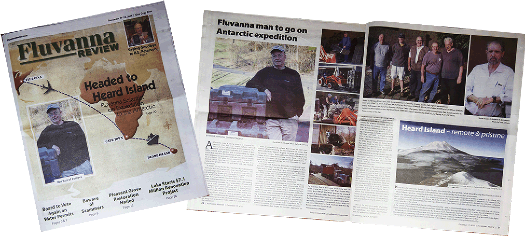 |
Jan. 14, 2016. Team member Kenneth Karr was recently profiled as a member of the VKØEK team, bound for Heard Island. The Fluvanna Review, the county newspaper in Ken's home area (Palmyra, Virginia), did a feature article on Ken and his central role in preparing for the expedition. Karr is not, he said, concerned about traversing the vast expanse of ocean that surrounds Heard Island. "I spent 25 years underwater in the world's oceans," Karr said with a smile, referring to his career in the submarine sevice of the Navy--including time as commander of two nuclear attack submarines. "I am looking forward to getting back on the water," he said. "It has been a while!" Ken was accepted as a member of the group partially because of his experience with managing projects and partially for his ability to operate radios on amateur frequencies. Ken's radio callsign is NG2H. The radio operation will be a major effort wihile the group is on the island, together with the scientific program related to biodiversity and climate change. The article included a salute to the local (Fluvanna) support group, including Dave Scott (KN4ZQ), James Kirkham (K4JK), Manny Rodriguez (K4MSR), Glenn Schumacher (W4XR), and Lee Moyer (K4ISW). |
FPVFactory PROVIDES EXPEDITION WITH SPLASHDRONE
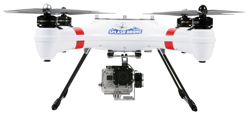 |
Jan. 14, 2016. The Heard Island field team is pleased to confirm that they will have a SwellPRO Splash drone on Heard Island. There’s only so much ground we cover and we are hopeful that the weather conditions will allow us to launch the SwellPRO splash drone to extend the coverage that we can achieve in our 3 week stay on Heard Island. The SwellPRO splash drone is a waterproof drone that can land in, and take off from water allowing the team to be confident using it along the shore line and in the glacial lagoons. And with a high incidence of “wet weather” days extra fly time that this will provide us is a welcome bonus. 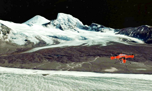
The team from fpvfactory, manufacturer of the SwellPRO Splash Drone, have provided us an Auto model along with spare parts (props, batteries and motors) to maximize our on-island use of the drone. The SwellPRO drone comes with some intelligent flight control smarts that will really assist our expedition “pilots”-
The Heard Island expedition team has received the drone in Sydney, and will be doing some pilot training before leaving for Cape Town in March.
|
RECENT DISCOVERIES PROVIDE THE BASIS FOR THE
RESEARCH PROGRAM ON HEARD ISLAND
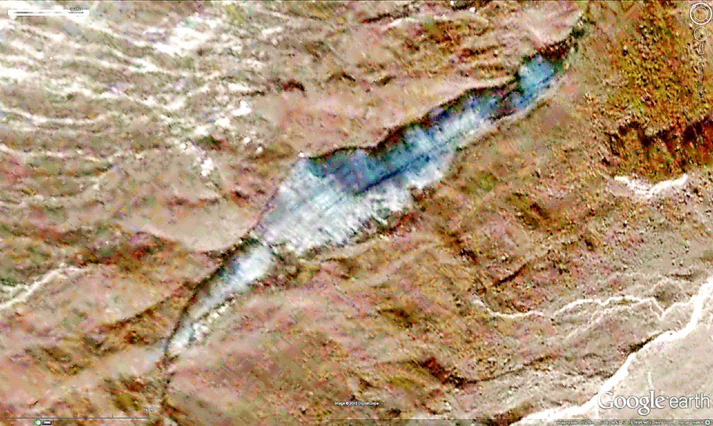
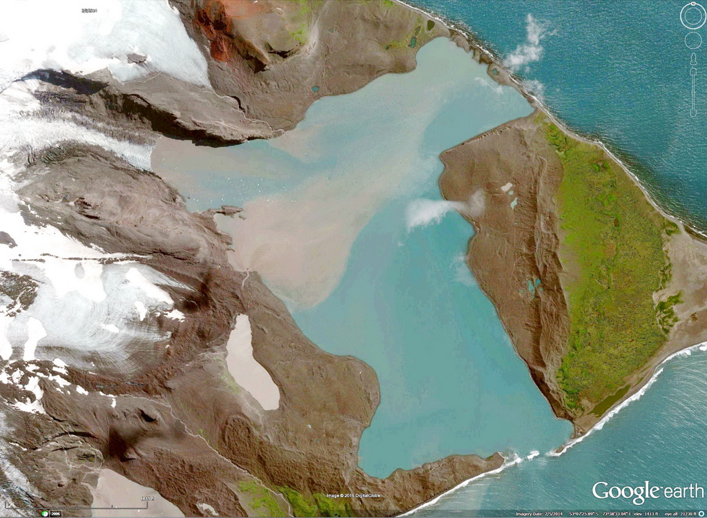
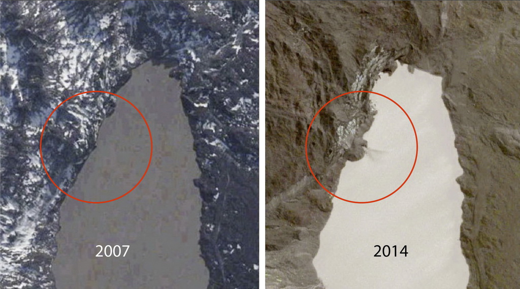
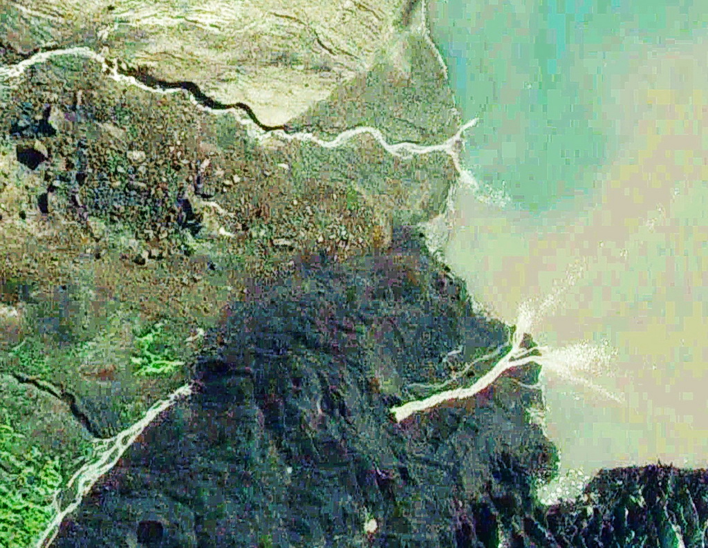
Jan. 12, 2016. Recently expedition members have made a number of significant discoveries about Heard Island that provide the basis and motivation for the research program, to be carried out simultaneously with the radio operation. An important part of the research will be the collection of a set of voucher specimens that will enable a large number of collaborating scientists to identify known and possibly new species, and to learn about the processes at work on this extremely dynamic system. Examples of these are given here. |
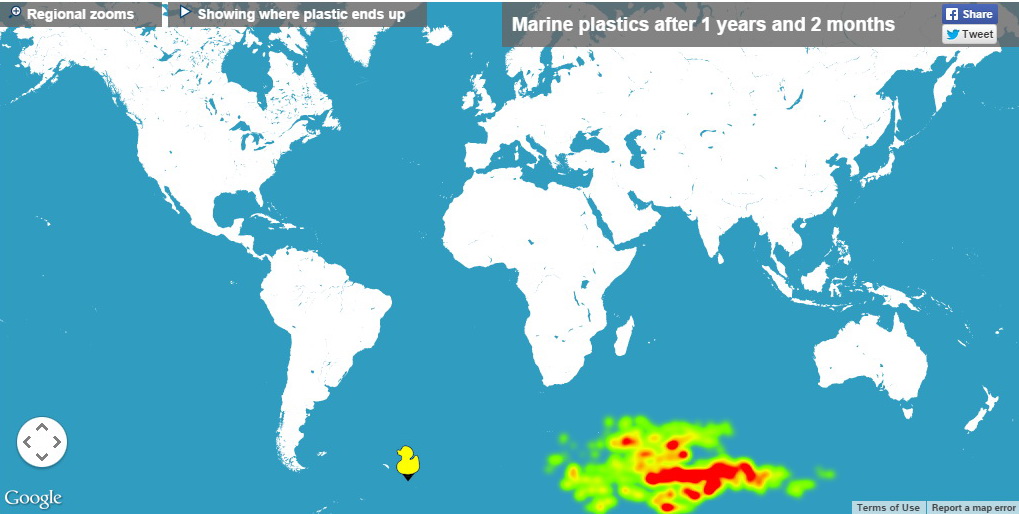
| Debris from South Georgia/South Sandwich Islands may end up at Heard Island. Simulations with the Adrift program show a direct wind-current driven path from SSG/SSI (duck icon) to HI, taking about 1 year. |
 |
| A major slumping process ("colluviation") reveals the bare flank of a glacier. The 800-foot-long "gash" moves upward as the deposits are washed from above and fill the lower margin. |
 |
| The Stephenson-Doppler Lagoon, built over the past 10 years from glacial melt due to global warming. The team will document the invasion of marine organisms into the lagoon enabled by the recent break in the seawall on the south edge. |
 |
| A rockfall in the tarn that feeds the Stephenson-Doppler Lagoon. The rockfall, which happened in 2008, opened a channel that carries an underground stream into the tarn. Below the water surface at the north end the water drains into an underground river that dumps large amounts of sediemnt into the lagoon (above). |
 |
| A glacial stream disappears underground and re-emerges 128 m later. Numerous examples of streams punching through recent lava flows were discovered in a comprehensive analysis of satellite images by R. W. Schmieder. |
 |
| A large stream emerges directly from a fissure. More than 100 such "spring-streams" were discovered in 2014 images of Heard Island. The team will collect water samples from such streams to probe the inaccessible volcanic rocks on Big Ben. |
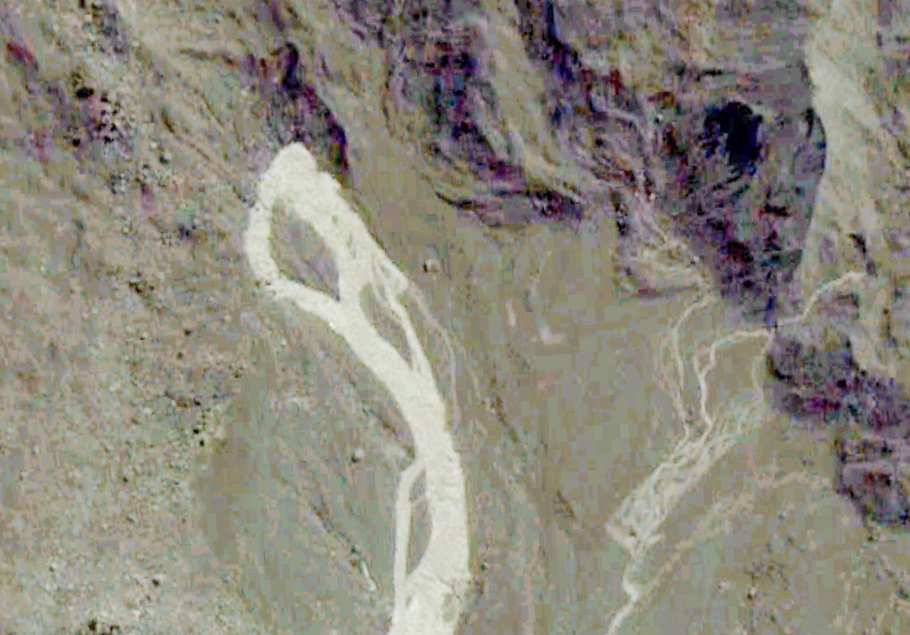 |
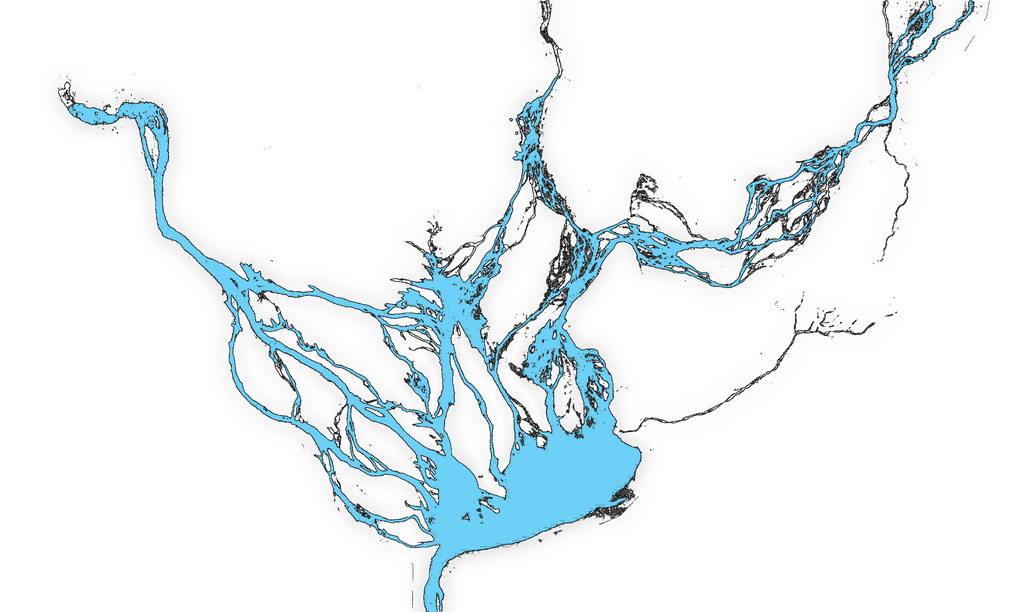
| A broad braided stream plain (about a half-mile across) on the north side of Heard Island. The team will attempt to collect samples of this and similar areas in a search for microscopic species to extend the known biodiversity of the island. |
 |
| Expedition Leader Robert Schmieder has described seven major projects that will be carried out, each involving collection of samples and specimens for offsite laboratory analysis. The complete manuscript for each of these projects is available at the following links. |
| TITLE | PDF MB |
| The volcanic history of Heard Island | 1.0 |
| Macroscopic inclusions in retreating glaciers on Heard Island | 1.8 |
| Biogeochemical composition of the subglacial regime on Heard Island using glacial streams as remote sampling probes | 4.6 |
| Rafting from South Georgia/South Sandwich Islands as an immigration pathway to Heard Island | 1.2 |
| First colonizers of very recent glaciomarine lagoons on Heard Island | 3.2 |
| Diversity: 1. Search for Xanthophyceae incultures of soil samples at Heard Island | 1.0 |
| Debris on Heard Island | 1.1 |
VKØEK APPOINTS TIM BEAUMONT MØURX AS QSL MANAGER
Jan. 6, 2016. We are pleased to announce that Tim Beaumont, MØURX, will provide the QSL manager service for VKØEK, with cards printed by Max, ON5UR. DXA will be the DXers primary interface with the expedition, and DXers will be able to request their QSLs via the DXA and VKØEK web pages, with QSL requests fulfilled by Tim and Max’s United Radio QSL Management Bureau. Online requests for direct cards are preferred, although direct paper QSLs via MØURX will also be accepted. Bureau requests will also be made via DXA/VKØEK. To provide efficient service and to reduce workload on the bureau system, all bureau requests should be made on-line. |
VKØEK PLANS AN INNOVATIVE BANQUET PRESENTATION
AT THE 2016 INTERNATIONAL DX CONVENTION
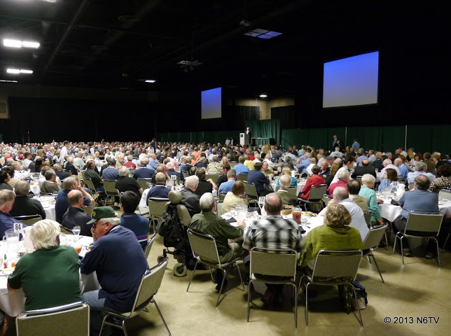 |
| View of the banquet at a past International DX Convention in Visalia. [Photo N6TV by permission] |
Dec. 17, 2015. We are pleased to announce that we have been invited to make the banquet keynote presentation at the International DX Convention (IDXC) at Visalia, California, April 16, 2016. The invitation was extended by Jeffrey Wolf, Program Chairman for the convention, and confirmed by the IDXC Committee. The presentation is likely to be a major departure from the conventional after-dinner talk, because we will still be on the DXpedition on April 16, the date of the dinner! We turned this challenge into an opportunity to demonstrate some of the new technology we have implemented for VKØEK. Co-organizer Rich Holoch KY6R will lead the presentation, possibly with the help of other members of the local support and technology development team. You are probably aware that we have put considerable effort into implementing internet-based services to improve your opportunity to log a QSO with VKØEK and to enhance the DXing experience. For example, the web page DXA will give you confirmation of your QSO within 1 minute after we log it, and in the presentation we will show how it worked on VKØEK. Other services include the ability to exchange messages with the VKØEK team, and to see images and video from the island in virtually real-time. Many of our technology advances are made possible by a major corporate sponsor who has provided multiple satellite terminals and unlimited air time. At the IDXC banquet, we expect to be able to show high-resolution images and video uploaded directly from Heard Island. In addition, we are working to provide a live interactive link to the convention banquet, using the large display capabilities of the Visalia Convention Center. Assuming these links work, we think you'll find this presentation the one to remember, so we hope you'll be there for this interesting event! |
OCEANEARTH PARTNERS WITH CORDELL EXPEDITIONS
FOR TEMPERATURE/LIGHT SURVEY ON HEARD ISLAND
|
||||||
| Dr. Steve Smith, Managing Director of Oceanearth, Inc., shows the Onset HOBO data logger. His group is providing 16 of these units to the Heard Island Expedition, to monitor the temperature and light intensity. The units record the measurements every 15 minutes, and are capable of operating for up to 1 year, although these units will be recovered and returned after the stay on the island. | ||||||
Dec. 17, 2015. We are pleased to announce that Dr. Stephen E. Smith, Managing Director of Oceanearth, Inc., a California based 501(c)(3) environmental non-profit, will be collaborating with the Heard Island Expedition by supplying a set of Onset HOBO Pendant Data Loggers to be deployed on Heard Island for the duration of the expedition. The loggers will record environmental temperature and solar insolation values in 16 terrestrial and underwater sites near the project encampment. The collected environmental data will be streamed back to California for analysis by Oceanearth staff and is expected to provide insights as to the conditions experienced by the island fauna in both exposed and hypolithic locations. Oceanearth’s mission is to promote the conservation of the world’s biological and cultural resources. Since its founding in 1995, it has provided on-going financial and logistical support for coral reef monitoring and protection projects in Federated States of Micronesia. Additionally, Oceanearth provides training in SCUBA and scientific diving protocols and techniques and supplies dive safety supervisory personnel for multi-institutional underwater archaeology field schools operated under the standards of the American Academy of Underwater Sciences. |
||||||
FACILITES AND EQUIPMENT SAIL FOR CAPE TOWN
 |
||||
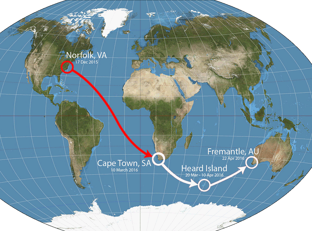
| The facilities and equipment for the 2016 Heard Island Expedition will travel midway down the Atlantic (red path), and from there the cargo will travel on the Braveheart to Heard Island and Western Australia | ||||
Dec. 17, 2015. It is with pleasure that we announce that our container of facilities and equipment left the Port of Norfolk, VA, today aboard the Kuala Lampur Express, to begin its journey across the Atlantic Ocean to Cape Town, South Africa. The cargo weighs 4 tons and is valued at over 1 million dollars. The track of the vessel is rather close to a great-circle path. It is scheduled to arrive in Cape Town on Jan. 31, 2016.
|
||||
EXPEDITION FACILITIES ARE PACKED AND SHIPPED
Will sail for Cape Town, South Africa, Dec. 17
Dec. 8, 2015. Today a major milestone was reached: Virtually the entire expedition cargo, including tents, furniture, facilities, equipment, supplies, tools, and some personal gear, was packed in a sea container and sent to the Norfolk, VA, port, for staging. In an ironic twist, delivery of one of the antennas was delivered a day late, but the container also arrived a day late so all the gear was in fact loaded, and none left behind. On Dec. 17 it will sail for Cape Town, South Africa, to be put in storage awaiting the team arrival around March 1, 2016. The cargo occupied about 800 cu. ft. (36 cu. m) and weighed about 8000 lbs. (4 tons, 3600 kg.). A few items, including the four BGAN satellite terminals and the digital microscope, were held back for testing and further development of the software, and will be air-shipped to Cape Town in late February.
|
MAJOR GRANTS MOVE FUNDING CLOSE TO GOAL
| Dec. 4, 2015. We are very pleased to report that recently several major grants have been received. ... | ||
 |
The ARRL has made a grant of nominally $2000, the "Colvin Award," for VKØEK. This award is given to selected DXpeditions "in support of Amateur Radio projects that promote international goodwill in the field of DX." Cordell Expeditions has received this award on three occasions: VKØIR (1997), K7C (2005), and TX5K (2013). This year the $6000 award was shared equally between three DXpeditions, all of which will take place in early 2016. This award is listed in the Elephant Seal Society category. | |
 |
The Southwest Ohio DX Association (SWODXA) made a grant of $1000 to VKØEK. That organization is the sponsor of the Dayton, OH, Hamvention, the largest in the world, and annually designate one DXpedition as the "DXpedition of the Year." Cordell Expeditions has received the DXoftY award twice before, for XKØY (1995) and VKØIR (1997). This award is listed in the Elephant Seal Society category. | |
 |
The Amateur Radio Club of Lucerne, Switzerland, sent more than $600 for VKØEK, a very significant commitment from a relatively small group. It didn't hurt to have one of our team members, Hans-Peter HB9BXE, a member of that group! This award is listed in the Cormorant Club category. | |
| With these grants, the expedition is now within less than 5% of its original funding goal, thereby certain to have full funding by the time of sailing (March, 10, 2016). We thank all contributors, and look forward to completing this phase of the project. | ||
CALIFORNIA EQUIPMENT SHIPPED TO STAGING SITE
| ||
|
Nov. 23, 2015. After more than three years of planning and more than a year of development, the core operating equipment has left California for the collection point on the East Coast. The equipment includes all eight radio stations, all the coax, living items, scientific lab and supplies, and landing and emergency gear. The 31 cases and other items filled five pallets, which are now traveling by truck to Palmyra, VA, to be combined with the tents, antennas, generators, bunk beds, and other equipment already collected there. On Dec. 7, the entire collection will be loaded in a container that will sail for Cape Town, South Africa, awaiting the team's arrival around March 1, 2016. The testing, packaging, and shipping of the equipment required considerable effort and coordination. Team members Dave K3EL, Jim N6TQ, Carlos NP4IW, and Bob KK6EK were joined by California team members Rich KY6R, Mike KJ4Z, Jack K6JEB, Peter W6DEI, Elliot N6PF, and Bob's XYL Kay. Two joggers, Chris Cubanske and Jason Vitucci, were "conscripted" on the spot to assist in moving the heavy pallets to the truck. The transportation was arranged by Kassie Nichols, The Freight Rate Company in Florida. |
INSIGHT AERIAL TECHNOLOGIES PROVIDES DRONE TO STUDY
RECENT GLACIAL AND GEOLOGICAL CHANGES
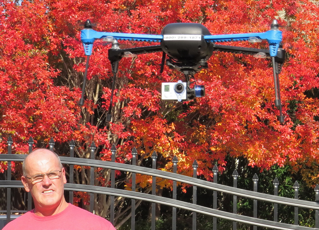 |
| Heard Island team member Jim Colletto watches the drone hover, stabilized by signals from 7 satellites. The drone held its position within inches. It will be used to obtain images of terrain inaccessible to the expedition field parties. |
|
Mr. Dave Cloonan, founder and owner of Insight Aerial Technologies, provided the craft without cost to the expedition. The company uses a fleet of drones to make aerial surveys of properties and buildings for planning, construction, and public information. The value of the drone to the Heard Island Expedition is that it will enable us to obtain images of features that are inaccessible on foot. Satellite images show clear evidence of major changes since the last scientific expedition, including glacial retreat, opening of new underground streams carrying massive amounts of glacial meltwater, the filling of a major new lagoon, and geomorpholical features such as slumping, rockfalls, and changes in sediment deposits. With the drone we have the potential to obtain confirmation of these changes, and also to discover new changes that might have occurred since the most recent satellite images (2014). At the extremely high rate of change of the subAntarctic environment, it is imperative to observe and document as many climate-related changes as possible, and the IAT drone should help us do that. We sincerely thank Dave Cloonan for this sponsorship. [Source: http://www.insightaerialtech.com] |
NORTHERN VIRGINIA COMMUNITY COLLEGE PROVIDES GIGAPAN
FOR GENERATING
ULTRA-RESOLUTION IMAGES
The EPIC series of robotic camera mounts capture photos using almost any digital camera; GigaPan Stitch Software automatically combines the thousands of images taken into a single image; and Gigapan.com enables the unique mega-high resolution viewing experience. |
|
|
Nov. 19, 2015. We are pleased to report that Prof. Callan Bentley, an Assistant Professor of Geology at the Northern Virginia Community College, will provide a GigaPan camera mount to the expedition, a device and software that will enable taking extreme high-resolution images on Heard Island. GigaPan EPIC robotic mounts empower cameras to take hundreds, even thousands of photos, which are combined to create one highly detailed image with amazing depth and clarity. It will scan a high-resolution camera across a programmed field, capturing hundreds of very high resolution images ("facets"). Software then will join the facets to form one very large (=high resolution) image, with up to many gigapixels. Such images can capture fine details of the glaciers and rocky cliffs of the volcanos on Heard Island, providing valuable information for calibrating and interpreting satellite images, espeically of climate change effects. [Source: http://www.gigapan.com]. He is the Chancellor’s Commonwealth Professor of Geology (2015-2017), the 2012 Chancellor’s Award for Teaching Excellence, NOVA honored him with the Presidential Sabbatical Award in 2013, he received the Biggs Award for Geoscience Teaching Excellence from the Geoscience Education Division of the Geological Society of America in 2014, and the recipient of the SCHEV Outstanding Faculty Award in 2015. Callan teaches introductory geology courses there. He developed new courses including Snowball Earth, Regional Field Geology of the Northern Rockies, Regional Field Geology of the Canadian Rockies, and Regional Field Geology of Eastern California. In addition to publishing in the professional scientific literature, he contributes book reviews, travel stories, and cartoons to EARTH magazine and was a contributor to five geology and Earth science textbooks published by Pearson. He has become known as an innovator in digital geology, in particular for the use of GigaPan images of outcrops and samples, a technique that allows “virtual field experiences” for distance learners and students with disabilities. Contact information: http://www.nvcc.edu/home/cbentley/ [Source: http://cdn.vccs.edu/wp-content/uploads/2015/10/callan_bentley_bio.pdf]. |
U.S. GEOLOGICAL SURVEY
COLLABORATES ON SEARCH FOR
FORAMINIFERA TO STUDY CLIMATE CHANGE
|
||
| (Left above) The Ponar grab used to obtain bottom samples, provided by the U. S. Geological Survey. (Left below) Typical images of foraminifera, which are seen only with a microscope. (Right) Bottles and labeling materials for collecting samples of the soil and sediment on Heard Island, also provided by the U. S. Geological Survey. The goal of this research is to identify micro-organisms on Heard Island, particularly foraminifera, that will provide new historical data on climate change. | ||
|
Nov. 18, 2015. We are pleased to announce the collaboration of the U. S. Geological Survey on the Heard Island Project. Dr. Mary McGann, a specialist on foraminifera and a collaborator with Cordell Expeditions for 30 years, will collaborate on seeking a collection of forams at Heard Island. As in previous collaborations with Cordell Expeditions (e.g., Rocas Alijos, 1990), the Survey has provided materials for preserving samples of sediments and soil that might contain forams. These microscopic organisms sometimes look like snails, clumps of balls, seeds, or pollen, but they are very different animals. Forams are a mostly aquatic phylum of amoeba-like protozoa that construct calcium-carbonate shells (properly called "tests"). They are of great scientific interest because of their extensive fossil record that enables dating sedimentary rocks. Besides biostratigraphy, they are useful in paleoclimatology and paleoceanography. Specimens from Heard Island could contribute to our understanding of the climate record for the subAntarctic islands.At Heard Island, we plan to sample the very recent (last 10 years) large (1 mile across) lake created by the mile-plus retreat of the Stephenson Glacier at Spit Bay. While most forams are marine, the recent access of this lake to the open sea through the deteriorating seawall may allow for their incursion into the lake, slowly contributing to the deposits in the lake bottom and on its shores. In addition to the forams, the sediments we collect will contain other microscopic particles. Because we will have a digital microscope on the island, we will be able to upload images of these particles, giving Mary a chance to react to and advise on further collections while we are still on the island. This "real-time science" is an innovation enabled by the extensive capability of the satellite communications we have for this expedition.
Dr. McGann can be reached at: USGS Pacific Coastal & Marine Science Center |
EXPEDITION TAKES DELIVERY OF MAIN SHELTERS
SOUND SEAL AND ACOUSTICAL SOLUTIONS WILL PROVIDE
ACOUSTIC INSULATION
FOR MAIN OPERATIONS SHELTER
 |
 |
 |
 |
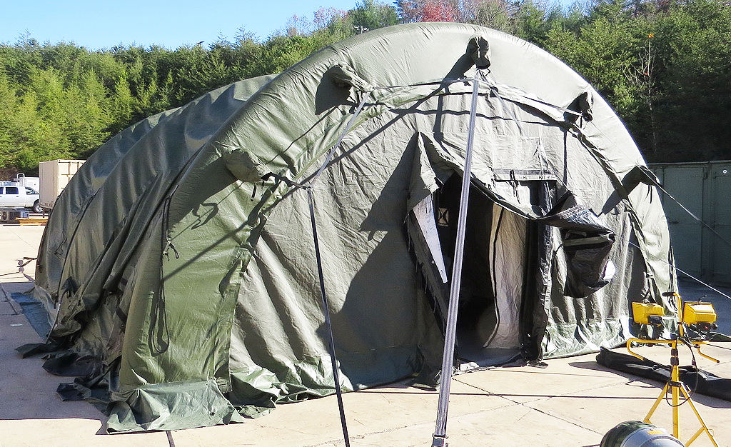
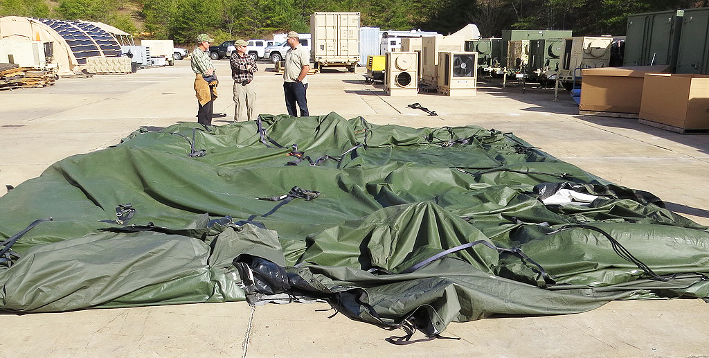
| (Top) One of the two main shelters provided by sponsor HDT Global, just before collapsing and packing. (Next) After collapse, the shelter packs into a canvas bag about 5 ft. long and 3 ft. in diameter. (Next) View of the HDT assembly area, showing airbeams in various stages of assembly. (Bottom) Five of the expedition team members who trained on the shelters at the HDT facility: Ken Karr NG2H, Dave Lloyd K3EL, Fred Belton KM4MXD, Arliss Thompson W4XU, and Bob Schmieder KK6EK. |
Nov. 16, 2015. In a long-anticipated significant event, the Heard Island Expedition has taken delivery of the four shelters provided by sponsor HDT Global, at their Buena Vista, VA, facility. The company delivered two STAT 21 20 ft. x 21 ft. airbeam shelters and two BASE X103 9.5 ft. x 15 ft. shelters. Five members of the expedition team and numerous members of the East Coast Support Team were on hand for the training session. The team erected and struck both types of shelters twice, recording the sequence for deploying them for training of the rest of the expedition team. The large airbeam shelters (top two images above) are erected by a simple air compressor in about 20 minutes, once the ground is prepared. They are anchored completely by four (large) steel stakes. The airbeams (third picture above) are so strong they can support a small truck. Inside, the flooring is a plastic sandwich that provides thermal insulation and a resiliant surface for comfort, and there is an interior lining that provides thermal insulation. An outside diesel-fired heater will keep the shelters warm. The shelters were transferred to the accumulation point in Palmyra, VA, awaiting shipment on Dec. 7 to Cape Town, South Africa. A day before sailing aboard the Braveheart (nominally March 10, 2016), the complete team will go through a dress rehearsal of the main campsite deployment, to minimize the setup time at Heard Island. We wish to express our appreciaiton to the HDT staff, including Ronnie Simmons, Scott Thompson, Carl Pates, Michelle Whitehurst, and CEO Andy Hove, for the very generous sponsorship of these shelters, and the excellent training program (and a nice pizza lunch!) they provided. We also appreciate very much the East Coast Support Team for multiple days of preparory work and transportation: Manny Rodriguez K4MSR, James Kirkham K4JK, Dave Scott KN4ZQ, Glenn Schumacher W4XR, and Lee Moyer K4ISW. |
|
||||||
| Cutaway/transparent view of the design for the main operations shelter. The insulating wall will provide separation between the meeting and lab area (far side of the curtain), and the radio operating stations (CW and SSB, near side). | ||||||
NEWS RELEASE
|
NETWORK AND SATELLITE TERMINALS PASS FINAL TEST
|
|
| Co-organizer Rich Holoch KY6R checks out the BGAN terminals, together with the WiFi and computer network destined to be deployed on Heard Island. This test used the actual BGAN terminals to be deployed, and the test proved that the system will work as designed. | |
|
Nov. 7, 2015. We have completed another milestone in implementing the IT system for the Heard Island expedition. Co-organizer Rich Holoch KY6R (shown above) assembled the complete computer network for the two locations (Atlas Cove and Spit Bay), together with the BGAN satellite terminals, and successfully tested the ability of the system to send messages and media from all four terminals simultaneously. A short video by Rich KY6R explaining the test is provided . The BGANs generate a WiFi hotspot that enables all computers to network together and to link directly through the satellite to the internet. The primary application of this system will be to operate DXA to enable DXers to get confirmaiton of their contacts within 1 minute. However, with four open satellite channels, we will be able to upload a huge (effectively unlimited) amount of data, images, and probably videos. In addition to the BGAN terminals, we will have several satphones, providing emergency communications and reports from the field teams away from the main camps. The system was engineered to reduce the complexity, and therefore the setup time, on the island. In fact, all the team has to do is turn on the computers and terminals, and they automatically connect to form the complete network. No cabling, configuring, or adjusting is necessary--it's completely plug-and-play. The system was engineered by various team members, principally Rich KY6R, Pete W6OP, Mike KJ4Z, Daniel WB4RFQ, with the principal driver being DXA, originally developed by Bob KK6EK, and Ken NG2H who secured the satellite terminals.We believe this is the first time a DXpedition will have full unrestricted satellite communications implementing effectively real-time (non-ham radio) communications. With this capability, a large number of important functions are possible, and we are in the process of evaluating these for potential use on the expedition. |
DISC-O-BED SPONSORS HEARD ISLAND EXPEDITION BUNKS
|
|
| The Cam-O-Bunk bed, manufactured by Disc-O-Bed. The bunks ship in a compact case (left), and can convert to a seating lounge (center) or a pair of separate cots (right). | |
|
Nov. 3, 2015. Disc-O-Bed has offered sponsorship of the bunk beds for the Heard Island Expedition. This very generous offer will enable the team to efficiently and comfortably occupy the Airbeam shelters provided by HDT Global (see below). The company will supply eight of the units. Disc-O-Bed is recognized across the globe for its unique ability to design and deliver bunkable strength in a ready-to-go sleep system. A family owned business since 1988, Disc-O-Bed is committed to challenging conventional cot wisdom. Their entrepreneurial staff is hard working and service oriented, proudly backed by a unique and awesome product. Through its patented disc system – hence the name - the company consistently meets and exceeds the extreme demands of Emergency Relief and Military Troop Deployment worldwide. We offer a product that is robust, transportable; simple to assemble, is hygienic and offers a quick, effective and comfortable sleep solution. Today, Disc-O-Bed's reputation for quality, strength, and comfort extends to sleep solutions and modular seating for outdoor enthusiasts and in-home users alike, especially where sleep space is at a premium. Beyond its exceptional product design, Disc-O-Bed is dedicated to customer service:
Experience extreme sleep with ready-to-go solutions from Disc-O-Bed.
|
NEWS ARCHIVES 2 (May 2015 - Nov. 2015)
NEWS ARCHIVES 1 (2014 - Apr. 2015)