- SCHMIEDER BANK
During 1988-91, Cordell Expeditions carried out a series of exploratory expeditions to an unnamed bank off Pt. Sur, about 25 miles south of Monterey, California. At that time, little was known about the topography of the bank. The expeditions revealed numerous features that proved sufficiently shallow (less than 25 fm) for diving. From surveys and dives carried out during 1988, CE generated a general description of the bank, and summarized it in a report [Schmieder, 1989]. Stimulated by this new knowledge, the boundary of the proposed Monterey Bay National Marine Sanctuary was extended to include the Pt. Sur area, including the (as-then unnamed) bank.
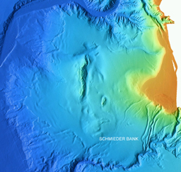
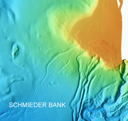
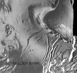
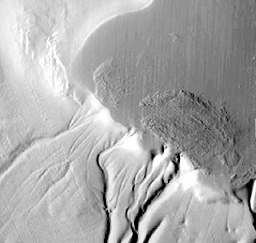
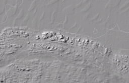
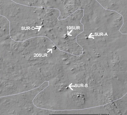
During 1986, NOAA carried out a high-resolution multibeam survey of the area as part of the Exclusive Economic Zone (EEZ) program [NOAA, 1986], and during 1998 the Monterey Bay Aquarium Research Institute (MBARI) contracted to carry out a high-resolution (5 m horizontal) survey. The high-resolution images of the Sur Shelf clearly show, for the first time, the details of the bank.
The bank lies about 3 nm WSW from Pt. Sur. Within the 75 m contour, the bank is roughly elliptical, with major axis NW-SE, enclosing an area of about 1 square nm. The surface of the bank is punctuated by a series of narrow ridges (running approximately parallel to the major axis), and numerous extremely sharp isolated pinnacled. Minimum depths are 36 m (one location) and 40 m (at least 4 locations).
Click to enlarge

- On Oct. 15, 1990, the U. S. Board on Geographic Names assigned the name "Schmieder Bank" to the bank off Pt. Sur, following a recommendations by Dr. Melanie Stright (U.S. Minerals Management Service), Dr. Paul Silva (UC Berkeley) and Dr. Sylvia Earle (NOAA Chief Scientist). This reference may be obtained online at http://www.geonames.org/ (click GNS Search, and check "Retrieve International Features in selected country with primary coordinates inside and outside of the country"). A facsimile of the search page is here.
We provide here a few images of Schmieder Bank, developed from images available on a CD distributed by MBARI.
Click to enlarge selected images
- On Oct. 15, 1990, the U. S. Board on Geographic Names assigned the name "Schmieder Bank" to the bank off Pt. Sur, following a recommendations by Dr. Melanie Stright (U.S. Minerals Management Service), Dr. Paul Silva (UC Berkeley) and Dr. Sylvia Earle (NOAA Chief Scientist). This reference may be obtained online at http://www.geonames.org/ (click GNS Search, and check "Retrieve International Features in selected country with primary coordinates inside and outside of the country"). A facsimile of the search page is here.
 |
 |
 |
 |
 |
 |
 |
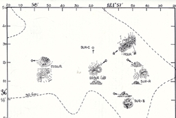
Data from the 1988 Cordell Expeditions |
REFERENCES:
Information about the naming of this feature may be obtained from: Trent Palmer, Secretary, US BGN ACUF, National Geospatial-Intelligence Agency, Attn: PTRGC, Mail Stop D-61, 4600 Sangamore Road, Bethesda, MD 20816. 301-227-3051
R. W. Schmieder, 1989. "The 1988 Expeditions to Pt. Sur. Summary of Results." Rept. CE-89-4, Cordell Expeditions, 80 pp. incl. color plates.
NOAA, 1986. EEX Bathymetric Survey, Project No. OPR-M539-DA-86, Description Report, Field No. DA-20-3-86, Register B-94.
NOAA, 1983. Navigational Chart 18686.